Chuquibambilla District
Chuquibambilla District is one of the fourteen districts of the Grau Province in Peru.[1]
Chuquibambilla District | |
|---|---|
 | |
| Country | |
| Region | Apurímac |
| Province | Grau |
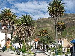
| Capital | Chuquibambilla |
| Government | |
| • Mayor | Wilfredo Pareja Ayerve |
| Area | |
| • Total | 432.5 km2 (167.0 sq mi) |
| Elevation | 3,320 m (10,890 ft) |
| Population (2005 census) | |
| • Total | 6,041 |
| • Density | 14/km2 (36/sq mi) |
| Time zone | UTC-5 (PET) |
| UBIGEO | 030701 |
Geography
One of the highest peaks of the district is Q'urawiri at approximately 5,000 m (16,000 ft). Other mountains are listed below:[2]
- Anta Pata
- Ch'aqu Urqu
- Ikma
- Lurituyuq
- Markayuq
- Nina Q'asa
- Pampa Urqu
- Puka Qaqa
- Pumani
- Puyani
- P'ukru
- Qillqas
- Qiwlla
- Qucha Pata
- Sasawini
- Suniq
- Suparawra
- Sura Pata
- Tipi Qucha
- T'uqu Pata
- Uqhu Pata
- Wayu
- Willka Marka
- Wisani
- Yana Qucha
- Yana Urqu
Ethnic groups
The people in the district are mainly indigenous citizens of Quechua descent. Quechua is the language which the majority of the population (61.60%) learnt to speak in childhood, 37.84% of the residents started speaking using the Spanish language (2007 Peru Census).[3]
See also
References
- (in Spanish) Instituto Nacional de Estadística e Informática. Banco de Información Digital Archived April 23, 2008, at the Wayback Machine. Retrieved April 7, 2008.
- escale.minedu.gob.pe/ UGEL map Grau Province (Apurimac Region)
- inei.gob.pe Archived January 27, 2013, at the Wayback Machine INEI, Peru, Censos Nacionales 2007, Frequencias: Preguntas de Población: Idioma o lengua con el que aprendió hablar (in Spanish)
| |
|---|---|
| Abancay | |
| Andahuaylas | |
| Antabamba | |
| Aymaraes | |
| Chincheros | |
| Cotabambas | |
| Grau | |
This article is issued from Wikipedia. The text is licensed under Creative Commons - Attribution - Sharealike. Additional terms may apply for the media files.