Chic-Choc Mountains
The Chic-Choc Mountains, also spelled Shick Shocks, is a mountain range in the central region of the Gaspé Peninsula in Quebec, Canada. It is a part of the Notre Dame Mountains, which is a continuation of the Appalachian Mountains.[1]
| Chic-Choc Mountains | |
|---|---|
 | |
| Highest point | |
| Peak | Mount Jacques-Cartier |
| Elevation | 1,268 m (4,160 ft) |
| Coordinates | 48°59′26″N 65°56′33″W |
| Dimensions | |
| Length | 95 km (59 mi) East-West |
| Width | 10 km (6.2 mi) |
| Geography | |
  | |
| Country | Canada |
| State/Province | Quebec |
| Range coordinates | 48°55′N 66°00′W |
| Parent range | Notre Dame Mountains |
History
The name Chic-Chocs comes from the Mi'kmaq word sigsôg, meaning "crags" or "rocky mountains." It has undergone many different spellings over time, including Chikchâks (1836), Shick-shock (1857), and Chick-Saws (1863).[1]
Geography
The Chic-Chocs run parallel to the St. Lawrence River and are located some 20 to 40 kilometers inland. They are a narrow band of mountains approximately 95 kilometres (59 mi) long and 10 kilometres (6.2 mi) wide.[1] The Chic-Chocs are heavily eroded, with rounded, flattened tops and steep sides. Over 32 mountains in the range have peaks higher than 1,000 metres (3,300 ft); the highest is Mount Jacques-Cartier at 1,268 metres (4,160 ft). Caribou can be found in the plateaus of this region.
Tourism
Although visited by just a few tourists, Chic-Choc Mountains became much more popular in the late 1990s as backcountry skiing gained popularity in Eastern Canada.
Some of the most popular backcountry skiing areas in the region include Mont Hogs Back, Mont Albert, Champ Mars, Mont Logan, and Mines Madeleine. The original guidebook for skiing in the Chic-Chocs was released in French by Avalanche Québec. In 2017, Ari Schneider wrote and published the first English guidebook for skiing in the Gaspésie.[2] Schneider's book was a much shorter introduction to skiing in the region than the original French guide, so Avalanche Québec released a full English version of their guidebook the following year.[3]
The mountains near Mont Saint Pierre are a destination for ice climbers.[4]
A network of trails, including the International Appalachian Trail, passes through these mountains. Quebec's Parc national de la Gaspésie protects most of the mountain range.
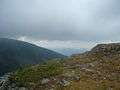 View from Mont Jacques-Cartier.
 Winter in the Chic Choc Mountains
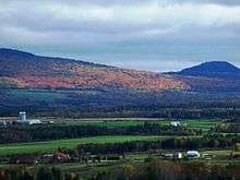 Near Sayabec
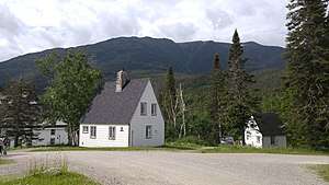
 Parc de la Gaspésie
References
- "Monts Chic-Chocs". Banque de noms de lieux du Québec (in French). Commission de Toponymie. Retrieved 1 Feb 2011.
- Schneider, Ari (2017). Gaspésie Select: Backcountry Skiing Québec's Chic-Choc Mountains. ISBN 978-1388322526.
- CHIC-CHOCS BACKCOUNTRY TOURING GUIDEBOOK (ENGLISH VERSION). Avalanche Quebec. 2018.
- Pellett, Alden. "Ice by the Sea". Climbing Magazine. Retrieved 2019-04-24.