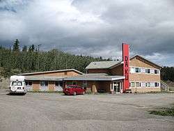
Champagne Landing
Champagne Landing is a small First Nations settlement on the Alaska Highway (historical mile 968, between Whitehorse and Haines Junction) in Canada's Yukon. The few residents are citizens of the Champagne and Aishihik First Nations.[1] The resident population was 25 in the Canada 2011 Census.[2]
Champagne Landing | |
|---|---|
 | |
 Champagne Landing | |
| Coordinates: 60°47′9″N 136°28′50″W | |
| Country | |
| Territory | |
| Area | |
| • Land | 4.53 km2 (1.75 sq mi) |
| Population (2011) | |
| • Total | 25 |
| • Density | 5.5/km2 (14/sq mi) |
| • Change 2006-11 | |
| Time zone | UTC-8 (Pacific (PST)) |
| • Summer (DST) | UTC-7 (PDT) |
History
Champagne is on the Dezadeash River, one of the tributaries of the Alsek. The original Dalton Trail connected to this settlement, and a roadhouse was built there in 1902. The Alaska highway no longer routes through the community, having been rerouted in the fall of 2002. The old roadway is still open to provide access. Many residents have moved to Haines Junction, where their nation has more services available.
References
- "Champagne Landing 10" Archived September 27, 2011, at the Wayback Machine. Aboriginal Canada Portal Archived April 9, 2011, at the Wayback Machine. Government of Canada. Accessed September 2010.
- Canada 2011 Census Community Profiles: Champagne Landing. Statistics Canada.
External links
| Wikimedia Commons has media related to Champagne Landing. |
| Regions | |
|---|---|
| Municipalities | |
| Communities | |
| Ghost towns | |
| Parks | |
| |
This article is issued from Wikipedia. The text is licensed under Creative Commons - Attribution - Sharealike. Additional terms may apply for the media files.