Chalk Flora Nature Reserve
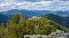
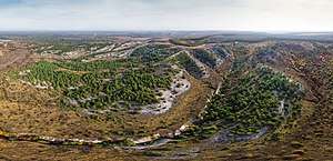
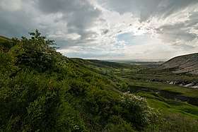
Chalk Flora Nature Reserve (Ukrainian: Крейдова флора (заповідник)) (also: Cretaceous Flora) is a protected nature reserve of Ukraine that lies on open chalk slopes of the riverine hills along the Donets River. The reserve is in the administrative Lyman and Sloviansk districts of Donetsk Oblast[1][2]. it is a sub-unit of the Ukrainian Steppe Nature Reserve, with an area of 1,134 hectares.
| Chalk Flora Nature Reserve | |
|---|---|
| Ukrainian: Крейдова флора (заповідник) | |
IUCN category Ia (strict nature reserve) | |
 Chalk Flora Nature Reserve | |
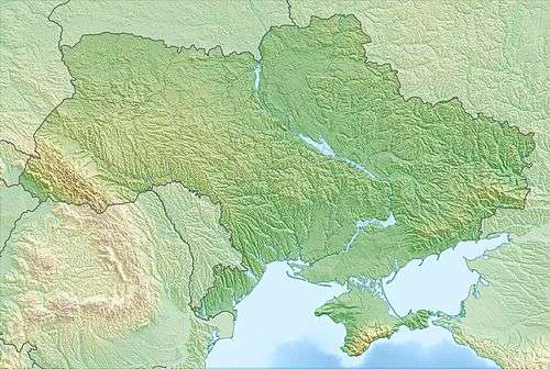 Location of Reserve | |
| Location | Donetsk Oblast, Lyman Raion |
| Coordinates | 48°52′23″N 37°53′09″E |
| Area | 1,134 hectares (2,802 acres; 11 km2; 4 sq mi) |
| Established | 1988 |
| Governing body | National Academy of Sciences of Ukraine |
| Website | http://pryroda.in.ua/creidoshyl/pro-zapovidnyk |
Topography
The ridge is about 50-70 meters above the surrounding territory, and steep - up to 70 degrees. The area has been preserved in large part because the land is not suitable for agriculture.
Climate and ecoregion
The climate of Chalk Flora NR is Humid continental climate, warm summer (Köppen climate classification (Dfb)). This climate is characterized by large seasonal temperature differentials and a warm summer (at least four months averaging over 10 °C (50 °F), but no month averaging over 22 °C (72 °F).[3][4]
Flora and fauna
About a third of the reserve territory is forest, surrounded by steppe. The forests are typically of chalk pine or birch. The steppe is of the multi-grass variety found in the mid-Ukrainian regions, on chalky soils and sow-hummus black soils.[2]
Public use
As a strict nature reserve, Chalk Flora's primary purpose is protection of nature and scientific study. Public access is prohibited.[1]
See also
- Lists of Nature Preserves of Ukraine (class Ia protected areas)
- National Parks of Ukraine (class II protected areas)
References
- "Chalk Flora Nature Reserve" (in Ukrainian). Official Reserve Website. Retrieved June 18, 2019.
- "Chalk Flora Nature Reserve" (in Ukrainian). Ukraine Incognita. Retrieved August 12, 2019.
- Kottek, M., J. Grieser, C. Beck, B. Rudolf, and F. Rubel, 2006. "World Map of Koppen-Geiger Climate Classification Updated" (PDF). Gebrüder Borntraeger 2006. Retrieved September 14, 2019.CS1 maint: multiple names: authors list (link)
- "Dataset - Koppen climate classifications". World Bank. Retrieved September 14, 2019.
External links
| Wikimedia Commons has media related to Nature Reserve Chalkland flora. |