Central-West Region, Brazil
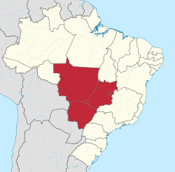
The Central-West or Center-West Region of Brazil (Portuguese: Região Centro-Oeste do Brasil) is composed of the states of Goiás, Mato Grosso and Mato Grosso do Sul; along with Distrito Federal (Federal District), where Brazil's national capital, Brasília, is situated. This Region is right in the heart of Brazil, representing 18.86% of the national territory.
Central-West Region Região Centro-Oeste | |
|---|---|
 Location of Central-West Region in Brazil | |
| Country | |
| States | Distrito Federal, Goiás, Mato Grosso, Mato Grosso do Sul |
| Area | |
| • Region | 1,612,077.2 km2 (622,426.5 sq mi) |
| Area rank | 2nd |
| Population (July 1, 2018) | |
| • Region | 16,085,885 |
| • Rank | 5 |
| • Density | 10.0/km2 (26/sq mi) |
| • Density rank | 4th |
| • Urban | 86.3% |
| GDP | |
| • Year | 2006 estimate |
| • Total | R$206,361,000,000 (4th) |
| • Per capita | R$14,604 (2nd) |
| HDI | |
| • Year | 2010 |
| • Category | 0.753 – high (3rd) |
| • Life expectancy | 73.2 years (3rd) |
| • Infant mortality | 19.5 per 1,000 (3rd) |
| • Literacy | 91.7% (3rd) |
| Time zone | UTC-04 (AMT) |
| • Summer (DST) | UTC-03 (AMST) |
With the move of the country's federal capital from Rio de Janeiro to Brasília in the 1960s, the construction of roads and railways to the interior of the country made access to the region easier, speeding up population growth and contributing significantly to the region's development.
Mato Grosso do Sul was created in 1979, materializing the decision of the government to divide the then called state of Mato Grosso in two states to facilitate to the administration and the development of the region.
Today, Center-West is attracting much investment for agriculture, livestock, and industries, and people from Southeast and Southern Brazil.
Brasília International Airport, Marechal Rondon International Airport, Campo Grande International Airport and Santa Genoveva Airport connects the Center-West region with many Brazilian cities and also operates some international flights.
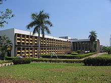
The Center-West is home to the University of Brasília, University Center of Brasília, Federal University of Goiás, Federal University of Mato Grosso do Sul, Federal University of Mato Grosso and Federal University of Rondonópolis.
The Center-West region is the second-least populated in Brazil.
Geography

Mato Grosso
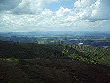
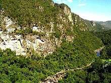
Mato Grosso is a state with a flat landscape that alternates between vast chapadas and plain areas. Mato Grosso contains three main ecosystems: the Cerrado, the Pantanal and the Amazon rainforest. Open pasture vegetation covers 40% of the state. The Chapada dos Guimarães National Park, with caves, grottoes, tracks, and waterfalls, is one of its tourist attractions. In the north is the biodiverse Amazonian forest, which covers nearly half of the state. The Xingu Indigenous Park and the Araguaia River are in Mato Grosso. Further south, the Pantanal, the world's largest wetland, is the habitat for nearly one thousand species of animals and many aquatic birds.
Mato Grosso do Sul
The Pantanal covers 12 municipalities of Mato Grosso do Sul and presents an enormous variety of flora and fauna, with forests, natural sand banks, savannahs, open pasture, fields and bushes. The area near Bonito has prehistoric caverns, natural rivers, waterfalls, swimming pools and the Blue Lake Cave. Mato Grosso do Sul has a humid subtropical and tropical climate.
The annual rainfall is 1,500 mm. January is the warmest month, with mean maxima of 34 °C (93.2 °F) and minima of 24 °C (75.2 °F) and more rain; July experiences the coldest temperatures, with mean maxima of 25 °C (77 °F) and minima of 15 °C (59 °F) and sun. The cerrado landscape is characterized by extensive savanna formations crossed by gallery forests and stream valleys. Cerrado includes various types of vegetation.
Goiás
The most populous state of the region, Goiás presents a landscape of plateaus and chapadões. At the height of the drought, from June to September, the lack of rain makes the level of the River Araguaia go down and brings up almost 2 km of beaches.
At the Emas National Park in the municipality of Chapadão do Céu, it is possible to observe the typical fauna and the flora from the region. At the Chapada dos Veadeiros the attractions include canyons, valleys, rapids and waterfalls. Other attractions are the historical city of Goiás (or Old Goiás), at 132 km from Goiânia, established at the beginning of the 18th century, and Caldas Novas, known for its hot springs.
Federal District
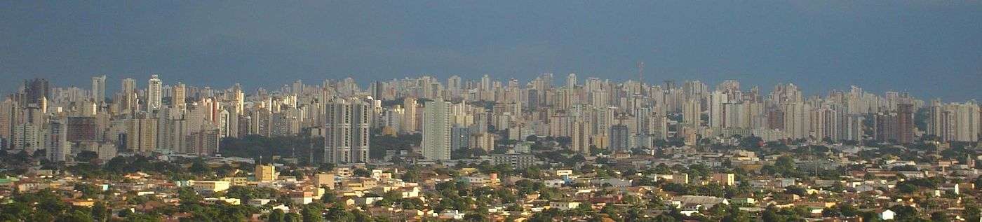
Located in the state of Goiás in a region called Planalto Central, the Federal District is divided in 31 administrative regions. Brasília - where the three branches of the federal government are located - is the main attraction of this dry area with only two seasons. The rainy season is from October to March.
During the dry season, the humidity can reach critical levels, mainly in the peak hours of the hottest days. The artificial lake of Paranoá, with almost 40 km² and 500 million m³ of water, was built to minimize the severe climatic conditions of the winter. The region also attracts mystics, and in its surroundings one can find many temples of different religions and sectarian groups.
Demographics
The Central-West Region has 237 cities. The most populated are the following:
Economy
The economy in the Central-West Region is essentially based on cattle breeding, which took the place of gold and precious stone prospecting, which were local activities in the past. Brazil's largest manganese reserve is found in the Central-West Region in Urucum Woods and 'political business' and tourism are also very important to the region.
- Vehicles: 3,944,768 (March/2007);
- Telephones: 3,168,026 (April/2007);
Education
Portuguese is the official national language, and thus the primary language taught in schools. But English and Spanish are part of the official high school curriculum.
Educational institutions
- University of Brasília (UnB)
- Universidade Federal de Mato Grosso (UFMT)
- Universidade Federal de Goiás (UFG)
- Universidade Federal de Mato Grosso do Sul (UFMS)
Tourism and recreation

Tourism has grown at impressive speed in the last decades there, attracting visitors from several parts of Brazil and the world; who all enjoy the Region's flora and fauna riches, as well as its numerous marvelous views.
Located in the middle of the vast Central Upland, the Central-West Region reveals how attractive the tours in the interior of the country can be. Starting in the west part of Mato Grosso do Sul State and the southeast part of Mato Grosso State, we have Pantanal Mato-grossense; the largest swampy plain area in the world, cut by the Paraguai River. Its fauna and flora riches draw the attention of the world. In the same state, it's possible to take tours through pleasant places, such as Alta Floresta, where ecotourism is the greatest attraction; Bonito, one of the places with the most crystalline waters in the country; and Chapada dos Guimarães National Park, full of mountains and beautiful landscapes offered by the meadow vegetation.
Dividing the States of Mato Grosso, Mato Grosso do Sul and Goiás, the Araguaia River attracts numerous fishermen from all parts of Brazil and the world. And in the State of Goiás, historical attractions, such as Pirenópolis draw many visitors all year long, with its steep stone-paved streets and its colonial houses. Other attractions in the same state include Chapada dos Veadeiros and the National Park of Emas, where the contact with nature is the essence of the tours. In the Federal District, the National Park of Brasília is one of the greatest local attractions.
Infrastructure
International airports
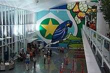
Brasília International Airport - President Juscelino Kubitschek (BSB/SBBR) serves the metropolitan area with major domestic and international flights. Brasília International Airport is the third largest in Brazil in terms of passenger movement. Because of its strategic location it is considered a civil aviation hub for the rest of the country. This makes for a large number of takeoffs and landings and it is not unusual flights to have to wait in the holding pattern to land. Following the airport's master plan, Infraero built a second runway, which was finished in 2006.
The runway at Marechal Rondon International Airport was opened to traffic in 1956. In February 1975, Infraero took over the airport's administration and began various upgrades to meet the needs of the airport complex. As of 1996, Marechal Rondon Airport, located 10 km (6.21 mi) from the city center, started receiving international flights. Currently it serves more than 900 thousand passengers a year.
The operation of Campo Grande International Airport is shared with the Campo Grande Air Base. The airport has two runways. Construction of the main runway, made of concrete, began in 1950 and was finished in 1953. The passenger terminal was concluded in 1964, and in 1967 concrete aprons were built for both military and civilian aircraft. As commercial aviation demand grew, it became necessary to widen the civil aircraft apron, which was completed 12 years after its construction. The airport has been administered by Inferaero since 1975.
National Airport
Santa Genoveva Airport is the main airport of Goiânia, providing flights to major cities in Brazil. Modernization work is underway to construct a new runway and terminal to handle the growing number of air passenger in and out of Goiânia.
References
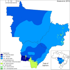
- Alvares, C. A.; Stape, J. L.; Sentelhas, P. C.; de Moraes, G.; Leonardo, J.; Sparovek, G. (2013). Köppen's climate classification map for Brazil. Meteorologische Zeitschrift, 22(6), 711-728.
- "2009 estimation from Instituto Brasileiro de Geografia e Estatística" (PDF). Instituto Brasileiro de Geografia e Estatística. March 30, 2010. Archived from the original (PDF) on June 26, 2013.
See also
- (in English) Brazil
- (in English) Brazilian Tourism Portal