Castletownkindalen
Castletownkindalen (Irish: Baile an Chaisleáin)[1] is a civil parish in County Westmeath, Ireland. It is located about 14.6 kilometres (9 mi) south–west of Mullingar.
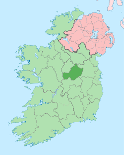
Castletownkindalen Baile an Chaisleáin | |
|---|---|
 Castletownkindalen Location of Castletownkindalen within County Westmeath in the Republic of Ireland | |
| Coordinates: 53°25′38″N 7°29′30″W | |
| Country | |
| Province | Leinster |
| County | County Westmeath |
| Irish grid reference | N338419 |
Castletownkindalen is one of 8 civil parishes in the barony of Moycashel in the Province of Leinster. The civil parish covers 11,368.2 acres (46.005 km2).
Castletownkindalen civil parish comprises the village of Castletown Geoghegan and 41 townlands: Adamstown, Ballybrennan, Ballybrown, Ballyhast, Ballykilroe, Ballynacoska, Ballynagore, Balrath, Benalbit and Derryroe, Bredagh, Castletown, Clonsingle, Cloonagh, Conranstown, Dooraheen, Dromore, Garhy, Glengorm, Gneevebeg, Gneevebrack, Keelbeg, Kilbalraherd, Kilhugh, Killalea, Killeen, Killinlahan, Kippinduff, Knockacurra, Lissakilly, Lurrig, Mabrista, Rathdrishoge, Rathnugent, Shurock, Sraduff, Sraneeg, Teernacreeve, Toorlisnamore, Tullaghanmore, Tullaghansleek and Tullaghnacrossan.
The neighbouring civil parishes are: Churchtown, Conry and Dysart (all in the barony of Rathconrath) to the north, Clonfad (barony of Fartullagh) to the east, Newtown to the east and south, Kilbeggan to the south and Ardnurcher or Horseleap to the west.[2][3]
References
- Castletownkindalen civil parish The Placenames Database of Ireland. Retrieved on 14 July 2015.
- Castletownkindalen civil parish, Co. Westmeath townlands.ie Retrieved on 14 July 2015.
- Castletownkindalen civil parish, Co. Westmeath The IreAtlas Townland Data Base. Retrieved on 14 July 2015.
External links
- Castletownkindalen civil parish at the IreAtlas Townland Data Base
- Castletownkindalen civil parish at townlands.ie
- Castletownkindalen civil parish at The Placenames Database of Ireland