Capac, Michigan
Capac is a village in Mussey Township, St. Clair County in the U.S. state of Michigan. The population was 1,890 at the 2010 census.
Capac, Michigan | |
|---|---|
 Location within St. Clair County | |
 Capac Location within the state of Michigan | |
| Coordinates: 43°00′43″N 82°55′41″W | |
| Country | United States |
| State | Michigan |
| County | St. Clair |
| Township | Mussey |
| Founded | 1857 |
| Government | |
| • Type | Village council |
| • President | John Gryzb |
| Area | |
| • Total | 1.88 sq mi (4.88 km2) |
| • Land | 1.83 sq mi (4.74 km2) |
| • Water | 0.05 sq mi (0.13 km2) |
| Elevation | 814 ft (248 m) |
| Population | |
| • Total | 1,890 |
| • Estimate (2018)[3] | 1,829 |
| • Density | 1,003.82/sq mi (387.52/km2) |
| Time zone | UTC-5 (Eastern (EST)) |
| • Summer (DST) | UTC-4 (EDT) |
| ZIP code(s) | 48014 |
| Area code(s) | 810 |
| FIPS code | 26-13140[4] |
| GNIS feature ID | 1624440[5] |
| Website | Official website |
History
Capac was founded and platted by a group of men from Romeo headed by George R. Funstan and Judge DeWitt C. Walker in 1857. The judge named it after Huayna Capac, Sapa Inca of the Inca Empire. A nearby post office named "Pinery" was transferred to and renamed "Capac" in January 1858. The Grand Trunk Railroad opened a station in 1866. Capac incorporated as a village in 1873.[6]
Preston Tucker, designer of the 1948 Tucker Sedan, was born near Capac in 1903. Tucker is the subject of the 1988 movie Tucker: The Man and His Dream.
Roman Gribbs, mayor of Detroit from 1970–74, was raised near Capac.
Geography
According to the United States Census Bureau, the village has a total area of 1.88 square miles (4.87 km2), of which 1.83 square miles (4.74 km2) is land and 0.05 square miles (0.13 km2) is water.[7]
Demographics
| Historical population | |||
|---|---|---|---|
| Census | Pop. | %± | |
| 1880 | 544 | — | |
| 1900 | 547 | — | |
| 1910 | 761 | 39.1% | |
| 1920 | 791 | 3.9% | |
| 1930 | 837 | 5.8% | |
| 1940 | 920 | 9.9% | |
| 1950 | 1,104 | 20.0% | |
| 1960 | 1,235 | 11.9% | |
| 1970 | 1,279 | 3.6% | |
| 1980 | 1,377 | 7.7% | |
| 1990 | 1,583 | 15.0% | |
| 2000 | 1,775 | 12.1% | |
| 2010 | 1,890 | 6.5% | |
| Est. 2018 | 1,829 | [3] | −3.2% |
| U.S. Decennial Census[8] | |||
2010 census
As of the census[2] of 2010, there were 1,890 people, 704 households, and 470 families living in the village. The population density was 1,032.8 inhabitants per square mile (398.8/km2). There were 807 housing units at an average density of 441.0 per square mile (170.3/km2). The racial makeup of the village was 87.7% White, 0.3% African American, 0.6% Native American, 0.1% Asian, 8.0% from other races, and 3.2% from two or more races. Hispanic or Latino of any race were 18.9% of the population.
There were 704 households, of which 40.1% had children under the age of 18 living with them, 45.6% were married couples living together, 13.8% had a female householder with no husband present, 7.4% had a male householder with no wife present, and 33.2% were non-families. 27.7% of all households were made up of individuals, and 11.7% had someone living alone who was 65 years of age or older. The average household size was 2.68 and the average family size was 3.30.
The median age in the village was 33.1 years. 29% of residents were under the age of 18; 11% were between the ages of 18 and 24; 25.4% were from 25 to 44; 24% were from 45 to 64; and 10.5% were 65 years of age or older. The gender makeup of the village was 48.1% male and 51.9% female.
2000 census
As of the census[4] of 2000, there were 1,775 people, 620 households, and 465 families living in the village. The population density was 1,096.5 per square mile (423.0/km2). There were 652 housing units at an average density of 402.8 per square mile (155.4/km2). The racial makeup of the village was 91.49% White, 0.39% African American, 1.07% Native American, 5.01% from other races, and 2.03% from two or more races. Hispanic or Latino of any race were 16.45% of the population.
There were 620 households, out of which 45.3% had children under the age of 18 living with them, 56.8% were married couples living together, 12.6% had a female householder with no husband present, and 25.0% were non-families. 21.5% of all households were made up of individuals, and 11.1% had someone living alone who was 65 years of age or older. The average household size was 2.86 and the average family size was 3.33.
In the village, the population was spread out, with 33.2% under the age of 18, 9.7% from 18 to 24, 31.4% from 25 to 44, 16.7% from 45 to 64, and 8.9% who were 65 years of age or older. The median age was 30 years. For every 100 females, there were 98.3 males. For every 100 females age 18 and over, there were 94.6 males.
The median income for a household in the village was $42,105, and the median income for a family was $47,727. Males had a median income of $40,739 versus $26,797 for females. The per capita income for the village was $16,297. About 8.1% of families and 10.9% of the population were below the poverty line, including 14.0% of those under age 18 and 3.9% of those age 65 or over.
Notes
- "2017 U.S. Gazetteer Files". United States Census Bureau. Retrieved Jan 3, 2019.
- "U.S. Census website". United States Census Bureau. Retrieved 2012-11-25.
- "Population and Housing Unit Estimates". Retrieved December 29, 2019.
- "U.S. Census website". United States Census Bureau. Retrieved 2008-01-31.
- "US Board on Geographic Names". United States Geological Survey. 2007-10-25. Retrieved 2008-01-31.
- Romig, Walter (1986) [1973]. Michigan Place Names. Detroit, Michigan: Wayne State University Press. ISBN 0-8143-1838-X.
- "US Gazetteer files 2010". United States Census Bureau. Archived from the original on 2012-07-02. Retrieved 2012-11-25.
- "Census of Population and Housing". Census.gov. Retrieved June 4, 2015.
Municipalities and communities of St. Clair County, Michigan, United States | ||
|---|---|---|
| Cities | 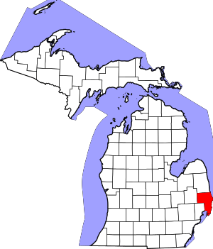 Map_of_Michigan_highlighting_St._Clair_County.svg | |
| Villages | ||
| Charter townships | ||
| General law townships | ||
| CDP | ||
| Other unincorporated communities |
| |
| Footnotes | ‡This populated place also has portions in an adjacent county or counties | |
| Authority control |
|
|---|