Bulverde, Texas
Bulverde (/bʊlˈvɜːrdi/ buul-VUR-dee) is a city in Comal County, Texas, United States. Bulverde is known for its small town, slow pace of life, coupled with the Germanic emigrant history of the town's founders. Bulverde was originally named Piepers Settlement after a prominent German pioneer.[5] The population was 4,630 at the 2010 census,[6] up from 3,761 at the 2000 census. It is part of the San Antonio Metropolitan Statistical Area.
Bulverde, Texas | |
|---|---|
| Motto(s): "Front Porch of the Texas Hill Country" | |
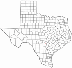 Location of Bulverde, Texas | |
 | |
| Coordinates: 29°44′55″N 98°24′48″W | |
| Country | United States |
| State | Texas |
| County | Comal |
| Area | |
| • Total | 15.83 sq mi (41.01 km2) |
| • Land | 15.82 sq mi (40.97 km2) |
| • Water | 0.02 sq mi (0.04 km2) |
| Elevation | 1,093 ft (333 m) |
| Population (2010) | |
| • Total | 4,630 |
| • Estimate (2019)[2] | 5,300 |
| • Density | 335.06/sq mi (129.37/km2) |
| Time zone | UTC-6 (Central (CST)) |
| • Summer (DST) | UTC-5 (CDT) |
| ZIP code | 78163 |
| Area code(s) | 830 |
| FIPS code | 48-11224[3] |
| GNIS feature ID | 1378070[4] |
| Website | bulverdetx |
Geography
Bulverde is located in western Comal County at 29°44′55″N 98°24′48″W,[7] about 26 miles (42 km) north of downtown San Antonio. U.S. Route 281 passes through the east side of Bulverde, leading south to San Antonio and north 25 miles (40 km) to Blanco. Cibolo Creek, which forms the Comal County/Bexar County line, runs just south of Bulverde.
According to the United States Census Bureau, the city has a total area of 9.7 square miles (25.2 km2), of which 0.01 square miles (0.02 km2), or 0.09%, is water.[6]
Demographics
| Historical population | |||
|---|---|---|---|
| Census | Pop. | %± | |
| 2000 | 3,761 | — | |
| 2010 | 4,630 | 23.1% | |
| Est. 2019 | 5,300 | [2] | 14.5% |
| U.S. Decennial Census[8] | |||
As of the census[3] of 2000, there were 3,761 people, 1,292 households, and 1,131 families residing in the city. The population density was 495.7 people per square mile (191.3/km2). There were 1,349 housing units at an average density of 177.8 per square mile (68.6/km2). The racial makeup of the city was 95.32% White, 0.32% African American, 0.32% Native American, 0.51% Asian, 0.03% Pacific Islander, 1.81% from other races, and 1.70% from two or more races. Hispanic or Latino of any race were 10.95% of the population.
There were 1,292 households, out of which 41.6% had children under the age of 18 living with them, 79.6% were married couples living together, 5.7% had a female householder with no husband present, and 12.4% were non-families. 10.1% of all households were made up of individuals, and 3.6% had someone living alone who was 65 years of age or older. The average household size was 2.91 and the average family size was 3.12.
In the city, the population was spread out, with 28.3% under the age of 18, 5.2% from 18 to 24, 27.7% from 25 to 44, 29.2% from 45 to 64, and 9.6% who were 65 years of age or older. The median age was 40 years. For every 100 females, there were 101.3 males. For every 100 females age 18 and over, there were 96.4 males.
The median income for a household in the city was $67,055, and the median income for a family was $68,019. Males had a median income of $49,245 versus $30,717 for females. The per capita income for the city was $26,887. About 1.5% of families and 2.3% of the population were below the poverty line, including none of those under the age of eighteen or sixty-five or over.
History
It is also called "The Front Porch of the Texas Hill Country". Bulverde's first people were Native Americans. A type of arrowhead known as the Bulverde Point is named after the style of arrowhead made by Native Americans who lived in the area during the period 2,500 to 600 B.C.[9]
Bulverde was settled in 1850 and called "Pieper Settlement", after Anton Pieper. It was mainly settled by German immigrants similar to nearby New Braunfels. For many years the closest post office was at Smithson Valley, and mail was delivered once a week to the house of Carl Koch in Bulverde. A local post office that operated from 1879 to 1919 was named for Luciano Bulverda, an early area landowner.[10]
In the period between 1996 and 1999, 5 separate municipalities were incorporated and combined in the Bulverde area to form the current City of Bulverde. This process required 22 separate elections.[11] In May 2015, the people of Bulverde voted to adopt a home rule charter to have more control over development.[12][13]
Education
Bulverde is served by the Comal Independent School District.[14]
Throughout the 1980s and as of 2017, the children of Bulverde fed into Smithson Valley High School. The sports teams from the high school regularly advance to compete at state championship levels.
Zoned schools:
- Rahe Bulverde, Johnson Ranch, Arlon Seay, and Bill Brown elementary schools[15]
- Most residents are in the Spring Branch Middle School zone, while some are in the Smithson Valley middle zone[16]
- Smithson Valley High School[17]
A private school, Living Rock Academy (LRA), opened its doors in August 2015. The school is the result of a group effort by local parents of fundamental Bible-teaching churches. LRA, home of the Bobcats, hosts students in PK4-12th grade.
There is also Bracken Christian School, a k4-12th school. It sits on a hilltop.
Notable people
- Felix "Doc" Blanchard ("Mr. Inside"), 1945 Heisman Trophy winner, died of pneumonia on April 19, 2009, in Bulverde[18]
- Jason LaRue, Major League Baseball player.[19]
- Nathan Macias, Republican former member of the Texas House of Representatives from Comal County[20]
- Augie Meyers, musician and singer, former member of Sir Douglas Quintet, and Texas Tornados
- Scott Casey, WCCW pro wrestler
Climate
The climate in this area is characterized by hot, humid summers and generally mild to cool winters. According to the Köppen climate classification system, Bulverde has a humid subtropical climate, Cfa on climate maps.[21]
References
- "2019 U.S. Gazetteer Files". United States Census Bureau. Retrieved June 26, 2020.
- "Population and Housing Unit Estimates". United States Census Bureau. May 24, 2020. Retrieved May 27, 2020.
- "U.S. Census website". United States Census Bureau. Retrieved 2008-01-31.
- "US Board on Geographic Names". United States Geological Survey. 2007-10-25. Retrieved 2008-01-31.
- https://texashillcountry.com/bulverde-texas-hill-countrys-front-porch/
- "Geographic Identifiers: 2010 Census Summary File 1 (G001): Bulverde city, Texas". U.S. Census Bureau, American Factfinder. Archived from the original on February 13, 2020. Retrieved August 4, 2015.
- "US Gazetteer files: 2010, 2000, and 1990". United States Census Bureau. 2011-02-12. Retrieved 2011-04-23.
- "Census of Population and Housing". Census.gov. Retrieved June 4, 2015.
- "Arrowhead Point Type Glossary". arrowheads.com. Archived from the original on 8 March 2012. Retrieved 28 July 2013.
- "Bulverde, TX". The Handbook of Texas. Texas State Historical Association. Retrieved 28 July 2013.
- "History of Bulverde". Sunrise 2025 Plan. City of Bulverde. Retrieved 19 April 2016.
- "Municipal Election Results". Municipal Election Results. City of Bulverde. Retrieved 19 April 2016.
- "City Charter". City Charter. City of Bulverde. Retrieved 19 April 2016.
- "City Limits and ETJ." City of Bulverde. Retrieved on August 27, 2016. Zoning map.
- "Elementary School Attendance Zones" (Archive). Comal Independent School District. Retrieved on August 28, 2016. Zones: Rahe Bulverde (Archive), Johnson Ranch (Archive), Arlon Seay (Archive), Bill Brown (Archive)
- "Middle School Attendance Zones" (Archive). Comal Independent School District. Retrieved on August 28, 2016. Spring Branch Middle zone (Archive); Smithson Valley Middle zone (Archive)
- "High School Attendance Zones" (Archive). Comal Independent School District. Retrieved on August 28, 2016. Smithson Valley HS zone (Archive)
- "Army's Mr. Inside, Doc Blanchard, Dies At 84". NCAA. November 29, 2010. Archived from the original on September 21, 2012. Retrieved 2011-05-04.
- Cardinals sign catcher Jason LaRue retrieved 2018-04-06.
- "Nathan Macias' Biography". votesmart.org. Retrieved February 22, 2014.
- Climate Summary for Bulverde, Texas
External links
- City of Bulverde official website
- Bulverde from the Handbook of Texas Online
Municipalities and communities of Comal County, Texas, United States | ||
|---|---|---|
| Cities | 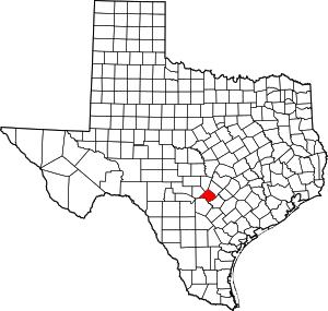 Comal County map | |
| CDP | ||
| Other unincorporated communities | ||
| Ghost town | ||
| Footnotes | ‡This populated place also has portions in an adjacent county or counties | |
| Authority control |
|
|---|