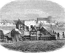
Bultfontein
Bultfontein is a town in the Free State province of South Africa with a total population of about 23,400 people. It is situated in the Tswelopele Local Municipality, about 100 kilometres (60 mi) north of Bloemfontein. The town site was laid out in 1873; it had been delayed because of a location dispute which also led to the establishment of Hoopstad 55 kilometres (35 mi) to the north-west.[3] The township of Phahameng was established on the outskirts of Bultfontein in the 1970s.
Bultfontein | |
|---|---|
 Bultfontein  Bultfontein | |
| Coordinates: 28°17′13″S 26°09′02″E | |
| Country | South Africa |
| Province | Free State |
| District | Lejweleputswa |
| Municipality | Tswelopele |
| Established | 1873[1] |
| Area | |
| • Total | 44.0 km2 (17.0 sq mi) |
| Population (2011)[2] | |
| • Total | 23,365 |
| • Density | 530/km2 (1,400/sq mi) |
| Racial makeup (2011) | |
| • Black African | 93.3% |
| • Coloured | 0.5% |
| • Indian/Asian | 0.5% |
| • White | 5.5% |
| • Other | 0.2% |
| First languages (2011) | |
| • Sotho | 56.7% |
| • Xhosa | 22.7% |
| • Tswana | 9.5% |
| • Afrikaans | 6.1% |
| • Other | 5.0% |
| Time zone | UTC+2 (SAST) |
| Postal code (street) | 9670 |
| PO box | 9670 |
| Area code | 051 |
According to the 2011 census, Bultfontein proper has a population of 2,176,[4] while Phahameng has a population of 21,189,[5] giving the urban area a total population of 23,365. Of this population 93% described themselves as Black African, 5.5% as White, and 0.5% as Coloured. 57% spoke Sotho as their home language, 23% spoke Xhosa, 9.5% spoke Tswana and 6% spoke Afrikaans as first language.
References
- "Chronological order of town establishment in South Africa based on Floyd (1960:20-26)" (PDF). pp. xlv–lii.
- Sum of the Main Places Bultfontein and Phahameng from Census 2011.
- Raper, Peter E. (1987). Dictionary of Southern African Place Names. Johannesburg: Lowry Publishers. p. 100. ISBN 0947042067.
- "Main Place Bultfontein". Census 2011.
- "Main Place Phahameng". Census 2011.
Places adjacent to Bultfontein | |
|---|---|
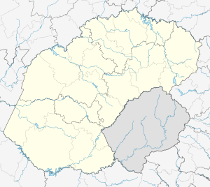
Municipalities and communities of Lejweleputswa District Municipality, Free State | ||
|---|---|---|
District seat: Welkom | ||
| Masilonyana | .svg.png) Lejweleputswa District within South Africa | |
| Tokologo | ||
| Tswelopele | ||
| Matjhabeng | ||
| Nala | ||