Boyne Island, Queensland
Boyne Island is a coastal town and locality in Queensland, Australia, 25 kilometres (16 mi) south of Gladstone. It is part of the local government area of Gladstone Region.[2] At the 2016 census, Boyne Island had a population of 4,760.[1]
| Boyne Island Queensland | |||||||||||||||
|---|---|---|---|---|---|---|---|---|---|---|---|---|---|---|---|
 Boyne Island | |||||||||||||||
| Coordinates | 23.9477°S 151.3550°E | ||||||||||||||
| Population | 4,760 (2016 census)[1] | ||||||||||||||
| • Density | 87.66/km2 (227.0/sq mi) | ||||||||||||||
| Postcode(s) | 4680 | ||||||||||||||
| Area | 54.3 km2 (21.0 sq mi) | ||||||||||||||
| Location | |||||||||||||||
| LGA(s) | Gladstone Region | ||||||||||||||
| State electorate(s) | Gladstone | ||||||||||||||
| Federal Division(s) | Flynn | ||||||||||||||
| |||||||||||||||
Geography
It is located on the west bank of the Boyne River and, is a particular type of island called a holm, an island in a river or an estuary. It is bounded on the Eastern side by the Boyne River, for about 4 km and the South Trees Inlet, on the southern, for 9 km, and western sides, for about 8 km Tannum Sands is located on the Eastern side of the mouth of the Boyne River spreading southward and is often referred to as Boyne Island's twin town.[3]
History
The town was named for the Boyne River, which was named by John Oxley in 1823.[2] Originally the island was used for sheep grazing, this was followed by small crops, horticulture, fishing and timber.
Boyne Island State School opened on 27 January 1953.[4]
Heritage listings
Boyne Island has a number of heritage-listed sites, including:
- William Wyndham's gravesite[5]
- Sayre Crescent: St Luke's Anglican Church[6]
Economy
Today Boyne Island is primarily a residential centre for the nearby Boyne Island aluminium smelter and Gladstone industries.
Australia's largest aluminium smelter, Boyne Smelters Ltd., is located north of the town separated by a buffer zone.
Education

Boyne Island State School is a government primary (Prep-6) school for boys and girls at 151 Malpas Street (23.9501°S 151.3564°E).[7][8] In 2017, the school had an enrolment of 361 students with 25 teachers (21 full-time equivalent) and 20 non-teaching staff (13 full-time equivalent).[9] It includes a special education program.[7]
Boyne Island Environmental Education Centre is an Outdoor and Environmental Education Centre at 61 Malpas Street (23.9573°S 151.3502°E).[7] It offers hands-on activities for students to learn about natural coastal, marine and reef environments of the area and to understand human use of these areas.[10]
Amenities
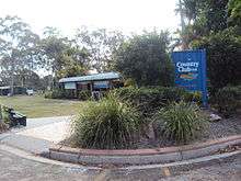
The 13 hole Boyne Island Tannum Sands Golf Course is located in Boyne Island adjacent to the Boyne River, in Jacaranda Drive.[11] Hole 12 in particular is challenging, with out-of-bounds and water hazard in strategic places.[11]
The Gladstone Regional Council operates a public library on Boyne Island at the corner of Wyndham & Hayes Avenue.[12]
Events
Boyne Island is home to the Boyne Tannum Hookup, which is a large fishing event held on the Labour Day long weekend in May each year. The event is held at Bray Park, which is on the river near the skate park. This event is very popular, with more than 3,000 entrants.[13]
References
- Australian Bureau of Statistics (27 June 2017). "Boyne Island (State Suburb)". 2016 Census QuickStats. Retrieved 17 April 2018.

- "Boyne Island (entry 4230)". Queensland Place Names. Queensland Government. Retrieved 8 July 2013.
- "Map of Boyne Island, QLD 4680 | Whereis®". www.whereis.com. Retrieved 6 December 2017.
- "Opening and closing dates of Queensland Schools". Queensland Government. Retrieved 18 April 2019.
- "William Wyndhams gravesite and remnant orchard trees (entry 601811)". Queensland Heritage Register. Queensland Heritage Council. Retrieved 8 July 2013.
- "St Luke's Anglican Church (entry 600385)". Queensland Heritage Register. Queensland Heritage Council. Retrieved 8 July 2013.
- "State and non-state school details". Queensland Government. 9 July 2018. Archived from the original on 21 November 2018. Retrieved 21 November 2018.
- "Boyne Island State School". Retrieved 21 November 2018.
- "ACARA School Profile 2017". Archived from the original on 22 November 2018. Retrieved 22 November 2018.
- "Boyne Island Environmental Education Centre". Retrieved 21 November 2018.
- "Boyne Island-Tannum Sands Country Club". Retrieved 21 October 2014.
- "Boyne Island Library". Public Libraries Connect. State Library of Queensland. Retrieved 24 January 2018.
- "About the Boyne Tannum Hookup". boynetannumhookup.com.au. Retrieved 6 December 2017.
External links
| Wikimedia Commons has media related to Boyne Island, Queensland. |