Boršt, Metlika
Boršt (pronounced [ˈbɔɾʃt]) is a small settlement on the left bank of the Kolpa River in the Municipality of Metlika in the White Carniola area of southeastern Slovenia. The entire area is part of the traditional region of Lower Carniola and is now included in the Southeast Slovenia Statistical Region.[2]
Boršt | |
|---|---|
 View of Boršt from the village of Škrilje | |
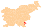
 Boršt Location in Slovenia | |
| Coordinates: 45°35′54.09″N 15°16′14.07″E | |
| Country | |
| Traditional region | White Carniola |
| Statistical region | Southeast Slovenia |
| Municipality | Metlika |
| Area | |
| • Total | 0.4 km2 (0.2 sq mi) |
| Elevation | 151.3 m (496.4 ft) |
| Population (2002) | |
| • Total | 56 |
| [1] | |
Name
The name Boršt is a relatively frequent name for settlements, regions, and hills in Slovenia. It is derived from the common noun boršt 'woods, forest', borrowed from Middle High German for(e)st 'woods, forest'.[3] Boršt was formerly known as Sveta Marjeta 'Saint Margaret' after the former church in the village. The church was mentioned in 1334 but fell into disrepair and was razed in 1925.[4]
History

Roman graves have been discovered near the village, testifying to human habitation in antiquity. In 1523 the Seignory of Gradac owned two farms in Boršt. Dominiče Manor (German: Dominitschhoff) stood to the southeast. The structure was built by Peter Dominitsch (Dominič); after his line died out, it came into the hands of the barons of Gusič, who owned the castle at Gradac. The manor later fell into decay.[4]
References
- Statistical Office of the Republic of Slovenia
- Metlika municipal site
- Snoj, Marko (2009). Etimološki slovar slovenskih zemljepisnih imen. Ljubljana: Modrijan. p. 72.
- Savnik, Roman, ed. 1971. Krajevni leksikon Slovenije, vol. 2. Ljubljana: Državna založba Slovenije, p. 448.
External links

- Boršt on Geopedia
| Settlements | Administrative centre: Metlika
|  |
|---|---|---|
| Landmarks |
| |
| Notable people | ||