Bernisse
Bernisse (![]()
Bernisse | |
|---|---|
Former municipality | |
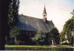 Church in Oudenhoorn | |
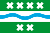 Flag | |
.svg.png) Location in South Holland | |
| Coordinates: 51°51′N 4°15′E | |
| Country | Netherlands |
| Province | South Holland |
| Municipality | Nissewaard |
| Area | |
| • Total | 68.46 km2 (26.43 sq mi) |
| • Land | 57.34 km2 (22.14 sq mi) |
| • Water | 11.12 km2 (4.29 sq mi) |
| Elevation | 0 m (0 ft) |
| Population (January 2019)[3] | |
| • Total | data missing |
| Time zone | UTC+1 (CET) |
| • Summer (DST) | UTC+2 (CEST) |
| Postcode | 3211–3218, 3227 |
| Area code | 0181 |
| Website | www |
The former municipality had a population of data missing in 2019, and covered an area of 68.46 km2 (26.43 sq mi) of which 11.12 km2 (4.29 sq mi) was water.
The former municipality was named after the river Bernisse, which flows right through it from the Spui to the Brielse meer and separates the estuary islands of Voorne and Putten.
The former municipality of Bernisse consisted of the following communities: Abbenbroek, Biert, Geervliet, Heenvliet, Oudenhoorn, Simonshaven, Zuidland.
The municipality of Bernisse was formed on January 1, 1980, through the amalgamation of the municipalities Abbenbroek, Oudenhoorn, Zuidland, and parts of the municipalities Geervliet (including Simonshaven) and Heenvliet.
Topography
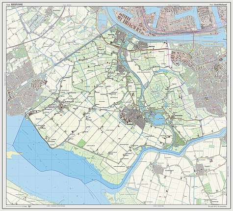
Dutch Topographic map of the former municipality of Bernisse, 2013.
Notable people
- Dirk van Hogendorp (1761 in Heenvliet – 1822) a somewhat "troublesome" Dutch officer and author
- Maarten den Bakker (born 1969 in Abbenbroek) a retired road bicycle racer, competed in the 1988 Summer Olympics
- Alexander van Oudenaarden (1970 in Zuidland) a Dutch biophysicist and systems biologist
- Chanella Stougje (born 1996 in Zuidland) a Dutch professional racing cyclist
References
- "Kerncijfers wijken en buurten" [Key figures for neighbourhoods]. CBS Statline (in Dutch). CBS. 2 July 2013. Retrieved 12 March 2014.
- "Postcodetool for 3216AG". Actueel Hoogtebestand Nederland (in Dutch). Het Waterschapshuis. Retrieved 14 July 2013.
- "Bevolkingsontwikkeling; regio per maand" [Population growth; regions per month]. CBS Statline (in Dutch). CBS. 1 January 2019. Retrieved 1 January 2019.
External links
| Wikimedia Commons has media related to Bernisse. |
Places adjacent to Bernisse | ||||||||||
|---|---|---|---|---|---|---|---|---|---|---|
| ||||||||||