Barduelva
Barduelva (Norwegian) or Álddesjohka (Northern Sami) (English: Bardu River[1][2]) is a river in Troms og Finnmark county, Norway. The 70-kilometre (43 mi) long river is located in the municipalities of Bardu and Målselv. The river flows from the lake Altevatnet northwest to the town of Setermoen, then north to the municipal border with Målselv (with the river forming part of the border) before finally emptying into the river Målselva, just outside the village of Bardufoss and the Bardufoss Airport.
| Barduelva | |
|---|---|
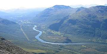 Bardu river, looking to the north | |
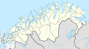 Location of the river  Barduelva (Norway) | |
| Location | |
| Country | Norway |
| County | Troms og Finnmark |
| Municipalities | Bardu, Målselv |
| Physical characteristics | |
| Source | Altevatnet |
| • location | Slåttmoberget, Bardu, Troms og Finnmark |
| • coordinates | 68.6559°N 18.8838°E |
| • elevation | 473 metres (1,552 ft) |
| Mouth | Målselva |
• location | Fossmoen, Målselv, Troms og Finnmark |
• coordinates | 69.0452°N 18.6198°E |
• elevation | 0 metres (0 ft) |
| Length | 70 km (43 mi) |
| Basin size | 2,769 km2 (1,069 sq mi) |
| Basin features | |
| River system | Målselvvassdraget |
Barduelva is the largest source of hydroelectricity in all of Troms county. There are three power plants on the river: Innset, Straumsmo, and Bardufoss. Combined, they generate 1,235 gigawatt-hours (4,450 TJ) of power annually.[3]
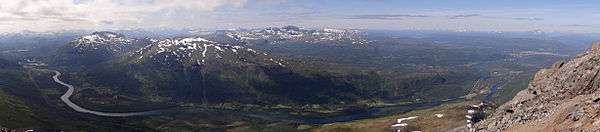
The stretch of the river between Setermoen and Andselv seen from near the top of Istinden.
References
- Library of Congress Subject Headings. 34th ed., vol. 6, T-Z. Washington, DC: Library of Congress, p. W-65.
- Douglas, John. 1972. The Arctic Highway: A Road and Its Setting. Newton Abbot, UK: David and Charles, p. 109.
- Store norske leksikon. "Barduelva" (in Norwegian). Retrieved 2010-04-04.
This article is issued from Wikipedia. The text is licensed under Creative Commons - Attribution - Sharealike. Additional terms may apply for the media files.