Bang Kapi District
Bang Kapi (Thai: บางกะปิ, pronounced [bāːŋ kāpìʔ]) is one of the 50 districts (khet) of Bangkok, Thailand. It is bounded by other Bangkok districts (from north clockwise): Bueng Kum, Saphan Sung, Prawet, Suan Luang, Huai Khwang, Wang Thonglang, and Lat Phrao.
Bang Kapi บางกะปิ | |
|---|---|
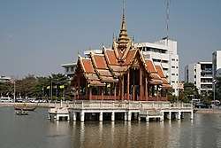 Thai Pavilion on the pool inside Ramkhamhaeng University | |
.jpg) Seal | |
 Khet location in Bangkok | |
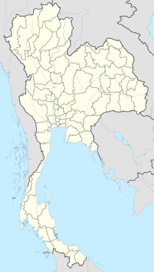 Bang Kapi Location in Thailand | |
| Coordinates: 13°45′57″N 100°38′52″E | |
| Country | Thailand |
| Province | Bangkok |
| Seat | Khlong Chan |
| Khwaeng | 2 |
| Area | |
| • Total | 28.523 km2 (11.013 sq mi) |
| Population (2017) | |
| • Total | 147,800[1] |
| • Density | 5,181.78/km2 (13,420.7/sq mi) |
| Time zone | UTC+7 (ICT) |
| Postal code | 10240 except Moo Ban Seri: 10250 |
| Geocode | 1006 |
History
The area of Bang Kapi has a history dating back to Rama III's reign, when Chao Phraya Bodindecha (เจ้าพระยาบดินทรเดชา) led a troop to fight rebels in Champassack and Louangphabang and brought back people to settle.
Because the people who settled here are mostly Muslim, most Thai in the early days call them "Kapiyoh". This referred to the (taqiyah) cap worn by Islamic men, and the name was shortened "Kapi", which became the name of the district.[2] "Bang" means a "hamlet by the waterfront" and is a common prefix for place names in Thailand.[3] It is unrelated to "Kapi", meaning shrimp paste.[2]
As it grew into a larger town, Bang Kapi was made an amphoe of Phra Nakhon Province. The amphoe was originally quite large, but has been divided since then to form new amphoe and districts.
In 1966, the Huay Khwang sub-district and parts of the Bang Kapi sub-district were spun off to form Phaya Thai District.
In 1972, Phra Nakhon and Thonburi were joined as the single province Krung Thep Maha Nakhon. Administrative districts in the capital city were changed from amphoe and tambon to districts (khet) and sub-district (khwaeng), respectively. Bang Kapi thus became a district of the newly combined province, having at that time nine sub-districts.
In 1977, the Sam Sen Nok sub-district was moved to Huai Khwang District.
In 1989, Lat Phrao District and Bueng Kum District were separated from Bang Kapi and became new districts.
On 14 October 1997, Wang Thonglang sub-district was elevated to a district, taking part of Khlong Chan sub-district with it.
Places

Education
- Ramkhamhaeng University
- National Institute of Development Administration (NIDA)[4]
- Rattana Bundit University
- Assumption University
- National Housing Authority
- Bang Kapi School
- Ramkhamhaeng Advent International School (RAIS)[5]
- Traill International School[6]
Temples
- Wat Bueng Thong Lang
- Wat Phra Kaisri Noi
- Wat Thep Leela
- Wat Wat Chanthawongsaram (klang)
- Wat Sri Bun Rueang
Shopping
- The Mall Ramkhamhaeng
- The Mall Bang Kapi
- Big C Hua Mak
- Bang Kapi market
- Tesco Lotus Bang Kapi
- Kwan Riam floating market
- Ramkhamhaeng night market
- Happy Land Market
- Homepro (Ramkhamhaeng road)
- Tawanna shopping park
- Makro Bang Kapi
Transportation
- Khlong Saen Saeb - Many piers for express boat service, including The Mall Bang Kapi. The mall Bangkapi boat pier.
- The Mall Bang Kapi bus station
- Ramkhamhaeng airport rail link station, located at Suan Luang District
- Hua Mak airport rail link station, located at Suan Luang District
Hospital
- Vejthani Hospital (private hospital)
- Ramkhamhaeng Hospital (private hospital)
Other
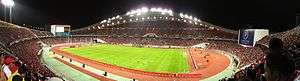
- Hua Mak Sports Complex (including Rajamangala Stadium)
- National Sport Museum,[7] located at Hua Mak Sports Complex
- Prasart Museum
- Water Park Fantasia Lagoon at The Mall Bangkapi[8]
Administration
The district is divided into two sub-districts (khwaeng).
| 1. | Khlong Chan | คลองจั่น | |
| 2. | Hua Mak | หัวหมาก |
District Council
The District Council for Bang Kapi has eight members, who each serve four-year terms. Elections were last held on 30 April 2006. The results were as follows:
- Democrat Party - Seven seats
- Thai Rak Thai Party - One seat
References
- "Population and House Report for Year 2017". Department of Provincial Administration, Ministry of Internal Affairs. Retrieved 2018-04-01. (Search page)
- dish 123 (July 2012). "ที่มาของชื่อ บางกะปิ ที่อยู่ในกรุงเทพมหานคร". Mthai.com (in Thai).
- Royal Institute Dictionary. "บาง". sanook.com (in Thai).
- "Map & Location Archived 2013-01-27 at the Wayback Machine." Niva International School. Retrieved on February 27, 2013.
- "Contact Us Archived 2013-02-25 at the Wayback Machine." Ramkhamhaeng Advent International School. Retrieved on 7 March 2013.
- "Traill International School." Traill International School, Bangkok. Retrieved on 6 March 2013.
- "Museum Thailand" — National Sport Museum, Bangkok.
- "Fantasia Lagoon Water Park at The Mall" — on Bangkok.com.
.svg.png)