Ban Luang District
Ban Luang (Thai: บ้านหลวง, pronounced [bâːn lǔa̯ŋ]) is a district (amphoe) in the western part of Nan Province, northern Thailand.
Ban Luang บ้านหลวง | |
|---|---|
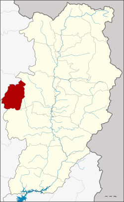 District location in Nan Province | |
| Coordinates: 18°51′5″N 100°26′18″E | |
| Country | Thailand |
| Province | Nan |
| Government | |
| • Marshal | Sunthorn Mahawongsanan |
| Area | |
| • Total | 338.210 km2 (130.584 sq mi) |
| Population (2009) | |
| • Total | 12,063 |
| • Density | 36/km2 (92/sq mi) |
| Time zone | UTC+7 (ICT) |
| Postal code | 55190 |
| Geocode | 5503 |
History
Originally the area was Tambon Suat of Mueang Nan District. It was created as Ban Luang Minor District (king amphoe) on 15 May 1975, when three tambons, Pa Kha Luang, Suat, and Ban Phi, were split off from Mueang District.[1] It was upgraded to a full district on 20 October 1993.[2]
Geography
Neighboring districts are from the east clockwise Mueang Nan, Wiang Sa of Nan Province, Song of Phrae Province, Chiang Muan and Pong of Phayao Province.
Administration
The district is divided into four sub-districts (tambons) which are further subdivided into 26 villages (mubans). There are no municipal (thesaban) areas, and four tambon administrative organizations (TAO).
| No. | Name | Thai name | Villages | Pop. | |
|---|---|---|---|---|---|
| 1. | Ban Fa | บ้านฟ้า | 8 | 3,663 | |
| 2. | Pa Kha Luang | ป่าคาหลวง | 5 | 2,889 | |
| 3. | Suat | สวด | 8 | 3,032 | |
| 4. | Ban Phi | บ้านพี้ | 5 | 2,569 |
References
- ประกาศกระทรวงมหาดไทย เรื่อง แบ่งท้องที่อำเภอเมืองน่าน จังหวัดน่าน ตั้งเป็นกิ่งอำเภอบ้านหลวง (PDF). Royal Gazette (in Thai). 92 (92 ง): 1192. May 3, 1975.
- พระราชกฤษฎีกาตั้งอำเภอลำทับ อำเภอร่องคำ อำเภอเวียงแหง อำเภอนาโยง อำเภอแก้งสนามนาง อำเภอโนนแดง อำเภอบ้านหลวง อำเภอกะพ้อ อำเภอศรีบรรพต อำเภอแก่งกระจาน อำเภอหนองสูง อำเภอสบเมย อำเภอเมยวดี อำเภอโคกเจริญ อำเภอทุ่งหัวช้าง อำเภอผาขาว อำเภอวังหิน อำเภอดอนพุด อำเภอบึงโขงหลง และอำเภอห้วยคต พ.ศ. ๒๕๓๖ (PDF). Royal Gazette (in Thai). 110 (179 ก special): 1–3. November 3, 1993.