Bagha Upazila
Bagha (Bengali: বাঘা) is an upazila of Rajshahi District in the Division of Rajshahi, Bangladesh.[1]
Bagha বাঘা | |
|---|---|
Upazila | |
 Bagha Location in Bangladesh | |
| Coordinates: 24°11.5′N 88°50′E | |
| Country | |
| Division | Rajshahi Division |
| District | Rajshahi District |
| Area | |
| • Total | 184.25 km2 (71.14 sq mi) |
| Population (1991) | |
| • Total | 153,931 |
| • Density | 840/km2 (2,200/sq mi) |
| Time zone | UTC+6 (BST) |
| Website | Official Map of Bagha |
Geography
Bagha is located at 24.1917°N 88.8333°E . It has 29056 households and total area 184.25 km².
Bagha Upazila is bounded by Charghat Upazila and Bagatipara Upazila, the latter in Natore District, on the north, Lalpur and Bagatipara Upazilas, both in Natore District, on the east, Daulatpur Upazila, Kushtia in Khushtia District, on the south and Jalangi CD Block, in Murshidabad district, West Bengal, India, on the west.[2][3]
Demographics
According to 2011 Bangladesh census, Bagha had a population of 184,183. Males constituted 49.96% of the population and females 50.04%. Muslims formed 94.70% of the population, Hindus 5.21%, Christians 0.03% and others 0.07%. Bagha had a literacy rate of 49.65% for the population 7 years and above.[4]
As of the 1991 Bangladesh census, Bagha has a population of 153931. Males constitute 51.48% of the population, and females 48.52%. This Upazila's eighteen up population is 77686. Bagha has an average literacy rate of 26.2% (7+ years), and the national average of 32.4% literate.[5]
History
Alaipur village of Bagha was the headquarters of Laskar Khan Jaigirdar during the sixteenth century. Hazrat Shah Doulah settled at Bagha and started preaching Islam. He also established a famous madrasa here.[6] Bagha thana of present-day Rajshahi district was a thriving centre of learning in the early Muslim period. The place became famous after Shah Muazzam Danishmand (Maulana Shah Daula) from Baghdad settled there during the reign of Sultan Nasir-ud-din Nusrat Shah (1519-32) and built his Khanqah there. An inscription table of the time of Sultan Nusrat Shah was discovered there that records the construction of a Jam’i mosque in 930 A.H. (1523-24 A.D.) One Abdul Latif visited the Bagha madrasah in 1609. There he met an elderly Sufi named Hawadah Main (Maulana Hamid Danishmand) son of Maulana Shah Daula, who was running a madrasah and a khanqah in a peaceful environment. Probably the madrasah was established during the reign of Nusrat Shah.[7]
Administration
Bagha has 2 Municipality, 7 Unions/Wards, 98 Mauzas/Mahallas, and 101 villages.
See also
- Upazilas of Bangladesh
- Districts of Bangladesh
- Divisions of Bangladesh
References
- AKM Kaisaruzzaman (2012), "Bagha Upazila", in Sirajul Islam and Ahmed A. Jamal (ed.), Banglapedia: National Encyclopedia of Bangladesh (Second ed.), Asiatic Society of Bangladesh
- "Bagha Upazila". Banglapedia. Retrieved 15 November 2018.
- "Tehsil Map of Murshidabad". CD Block/ Tehsil. Maps of India. Retrieved 15 November 2018.
- "Bangladesh Population and Housing Census 2011: Zila Report – Rajshahi" (PDF). Table P01 : Household and Population by Sex and Residence, Table P05 : Population by Religion, Age group and Residence, Table P09 : Literacy of Population 7 Years & Above by Religion, Sex and Residence. Bangladesh Bureau of Statistics (BBS), Ministry of Planning, Government of the People’s Republic of Bangladesh. Retrieved 9 December 2018.
- "Population Census Wing, BBS". Archived from the original on 2005-03-27. Retrieved November 10, 2006.
- "Bagha Upazila - Banglapedia". en.banglapedia.org. Retrieved 2019-10-01.
- Shakir, SAT (2012-06-30). "Islamic Education in Early Islamic Bengal". Clio:Jahangirnagar University Journal of the Department of History. 29.
| Upazila/Thana: | ||
|---|---|---|
Headquarters: Rajshahi | ||
| Bogra District | 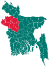 | |
| Joypurhat District | ||
| Naogaon District | ||
| Natore District | ||
| Nawabganj District | ||
| Pabna District | ||
| Rajshahi District | ||
| Sirajganj District | ||