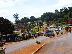
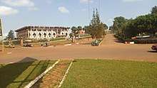
Bafoussam
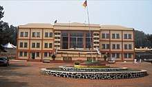
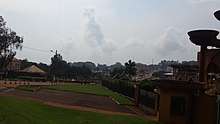
Bafoussam is the capital and largest city of the West Region of Cameroon, in the Bamboutos Mountains. It is the 3rd most important (financially) city in Cameroon, after Yaounde and Douala. The communauté urbaine (Urban Community) of Bafoussam, is a decentralized territorial collectivity. Originally called Urban Commune of Bafoussam, the communauté urbaine (Urban Community) of Bafoussam, was born after the Presidential Decree N ° 2008/022 of January 17, 2008 and composed of three communes, namely: the Commune of Bafoussam I (Bafoussam proper), the Commune of Bafoussam II (Baleng) and the Commune of Bafoussam III (Bamougoum).[1]
Bafoussam Fu'sap | |
|---|---|
Communauté Urbaine | |
 | |
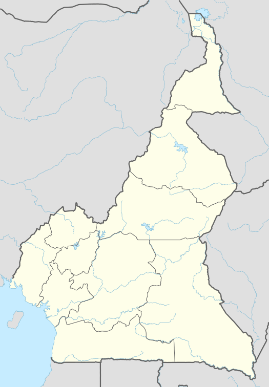 Bafoussam Location in Cameroon | |
| Coordinates: 5°28′N 10°25′E | |
| Country | |
| Regions | West |
| Department | Mifi |
| Settled | 14th Century |
| Incorporated (Town) | 1926 |
| Incorporated (city) | 2008 |
| Government | |
| • Government Delegate (Délégué du Gouvernement) | Nzété Emmanuel |
| Area | |
| • Communauté Urbaine | 402 km2 (155 sq mi) |
| • Urban | 91 km2 (35 sq mi) |
| Elevation | 1,521 m (4,990 ft) |
| Population (2019) | |
| • Communauté Urbaine | 1,146,000 (estimate) |
| • Density | 2,865/km2 (7,420/sq mi) |
| • Urban | 600,000 (estimate) |
| • Urban density | 6,593/km2 (17,080/sq mi) |
| • Metro | 1,146,000 (estimate) |
| • Major ethnic group | Bamileke |
| • Religions | Bamileke Religion, Christianity, Islam |
| Time zone | UTC+1 (West Africa Time) |
| Website | cubafoussam |
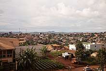
The city had an urban population of 347,517 inhabitants (at the 2008 Census). Bafoussam is the West Region centre of trade, and people are farming coffee, Potatoes, maize and beans. The city has also a coffee processing facility and brewery. It is the main city of the Bamiléké people and is home to the Bafoussam chief's palace. Bafoussam is a group composed of 07 villages (Bamendzi, Banengo, Ndiangdam, Ndiangsouoh, Ndiangbou, Toukouop, Ngoueng, and Banengo city B) with 46 districts or sub-villages. The main neighborhoods of the city are Banengo, Djeleng, Famla (also called Akwa), Kamkop, Quartier Eveché, Quartier Haussa and Tamdja.[2]
Bafoussam has two main markets (Marché A and Marché B), several internet cafés, restaurants and supermarkets, and a movie theater. Most of Bafoussam nightlife centers on the area called Akwa (so-named in honor of the neighborhood in Douala). Akwa features several bars, stores, and a live music venue, along with customary vendors of Soya (barbecue beef meat brochettes), Poisson braisé (barbecue fish) and other foods.[2]
This is the birthplace of the football player Geremi and his 17 brothers and sisters, as well as the birthplace of his cousin Pierre Webó.
History
The Bafoussam people originate from the Bamileke ethnic group, which are the natives of the same region. Claims are made that the Bamileke were descendants of the Baladis who left Egypt in the ninth century of our era. They arrived in the Tikar region around the middle of the twelfth century before dividing around 1360 when their last king, King Ndeh, died. Yende, the first prince, refused the throne and crossed the Nun (Noun river) to found the Bafoussam kingdom. His sister turned to the Banso area (there are about thirty Bamileke villages in the English-speaking North West). Two decades later, Ncharé, the youngest, went down to the plain of Noun to found the Bamoun kingdom. From Bafoussam were born almost all the other Bamileke Kingdoms, between the fifteenth century and the twentieth century (Bansoa was born in 1910 following the forced exile of Fo Taghe of Bafoussam)[3][4]
Name
Originally, Bafoussam is written in Bafoussam dialect "Pe Foussan" or "Pe Fussep" which literally means "people of ......". Over time, "Pe" has become "Ba" while retaining the same meaning.
When Westerners arrived, they united the two sound elements "Pe" and "Foussan" to make Bafoussam.
Another source, however, argues that Bafoussam is Fuh Sep's "bad western translation", meaning "we earn more by selling in detail than wholesale". According to this version, the Bafoussam would be a people who bought wholesale to resell in detail or who sold in detail by measuring in small baskets. Fuh here means to measure and Sap or Sep which means profit or treasure, to symbolize by the small basket in which one sold in detail. Pefuhssap or Pefuhssep means "those who have discovered that profit (treasure) is in retail".
It is nevertheless noted that the two sources of information on the origin of the name Bafoussam are not contradictory and it is safe to say that the Bafoussam left their place of residence from the Tikar plain with their name since they already practiced retail trade with small baskets.[2]
Birth of Bafoussam city
In 1945, an unexpected meeting between the colonial administrator of the Bamileke region (during the colonial times, the present day West region was called the Bamileke region) and the monarch of Fu'sap (Bafoussam), Chukhocha Paul, who ruled from 1933 to 1958, laid the foundation for increasing the importance of Bafoussam, which lied at the crossroads between British Southern Cameroons and French Cameroon.
By 1950, when Bafoussam became a subdivision of the French colonial administration headed by Jacques Lestrigang, very quickly, the village became cosmopolitan because located at the intercession of the tracks connecting the two Cameroon and also the cities charged with history that are Dschang, Foumban and Ngaoundéré. Thus the first servicing plan was designed by the French architect Dufayard. Its execution, associated with the dynamism of the populations which occupied it, had to trigger the skyrocketing of the city. Then came his twinning with the city of Bayeux, a city located in Calvados, France.
As the saying goes "for souls nobly born, valor doesn't await the passing of years", Bafoussam replaced Dschang a few years later as the capital of the West Region (then West Province) and equally replaced Nkongsamba as the economic hub of the region. Thus, important economic operators including the BEAC (Banque des Etats d'Afrique Centrale), Brasseries of Cameroon, and other industrial units in the making orchestrated a rush to the new city.[5]
On July 10, 1959, five rebel leaders were shot in the market square.[6]
Geography
Topography
Bafoussam is built in the foothills of the Banengo and Baleng hills that are covered with savannah vegetation. The city, located at about 1500 meters above sea level is built on stairs on the perimeters of Tamdja neighborhoods (1st floor), shopping center and Djemoum (2nd floor), Djeleng (3rd floor) and lower corners called Mairie rurale and Tougang (4th level).

Climate
The climate is constantly cool with a temperature oscillating between 15 ° and 22 °C. With climate change in recent years, Bafoussam sometimes reaches 28 °C during the dry season that extends from mid-November to mid-March (four months). The rainy season lasts eight months, from mid-March to mid-November.
Köppen-Geiger climate classification system classifies its climate as Subtropical highland Climate (Cwb) or an Oceanic Climate type (Cwb), featuring a dry and cool to cold winters and warm to cool summers (with cool nights in summers) with some few hot days,[7] however, its temperatures are lower than other locations with this classification due to its high elevation.
Its highest record temperature was 41 °C (106 °F) on April 28, 1981, while its lowest record temperatures was 0 °C (32 °F) on December 19, 1981.[8]
| Climate data for Bafoussam | |||||||||||||
|---|---|---|---|---|---|---|---|---|---|---|---|---|---|
| Month | Jan | Feb | Mar | Apr | May | Jun | Jul | Aug | Sep | Oct | Nov | Dec | Year |
| Record high °C (°F) | 33 (91) |
39 (102) |
37 (99) |
41 (106) |
39 (102) |
36 (97) |
35 (95) |
36 (97) |
33 (91) |
40 (104) |
34 (93) |
39 (102) |
41 (106) |
| Average high °C (°F) | 27 (81) |
27.6 (81.7) |
26.9 (80.4) |
26.1 (79.0) |
25.2 (77.4) |
23.8 (74.8) |
23 (73) |
23.2 (73.8) |
23.8 (74.8) |
24.1 (75.4) |
24.9 (76.8) |
25.9 (78.6) |
25.1 (77.2) |
| Daily mean °C (°F) | 20.7 (69.3) |
21.1 (70.0) |
21.6 (70.9) |
21 (70) |
20.3 (68.5) |
19.4 (66.9) |
19 (66) |
19 (66) |
19 (66) |
19.2 (66.6) |
19.8 (67.6) |
20.2 (68.4) |
20.0 (68.0) |
| Average low °C (°F) | 14.5 (58.1) |
14.7 (58.5) |
16.3 (61.3) |
16 (61) |
15.5 (59.9) |
15.1 (59.2) |
15 (59) |
14.9 (58.8) |
14.3 (57.7) |
14.3 (57.7) |
14.8 (58.6) |
14.5 (58.1) |
15.0 (59.0) |
| Record low °C (°F) | 8 (46) |
2 (36) |
3 (37) |
12 (54) |
11 (52) |
14 (57) |
3 (37) |
8 (46) |
4 (39) |
12 (54) |
11 (52) |
0 (32) |
0 (32) |
| Average precipitation mm (inches) | 11 (0.4) |
34 (1.3) |
106 (4.2) |
170 (6.7) |
184 (7.2) |
197 (7.8) |
255 (10.0) |
255 (10.0) |
321 (12.6) |
270 (10.6) |
58 (2.3) |
10 (0.4) |
1,871 (73.5) |
| Source 1: Climate-Data.org (altitude: 1432m)[7] | |||||||||||||
| Source 2: Voodoo Skies for record temperatures[8] | |||||||||||||
Waterfalls
The city is not very rich in natural rivers. The Mifi River runs along the southern part of the city to fall in the void creating the fall of the Metche. Other small streams including Megang, Nlom, and Vava exist in the city. Next to the fall of the Metche, which is a real attraction, Lake Baleng (this crater lake) is also a tourist attraction.[9]
Education
Bafoussam is home to a good number of high schools (including technical and vocational schools), lots of primary schools and kindergartens, and few institutions providing tertiary education. Most students upon graduation travel to other cities like Dschang, Yaounde, Douala, or Buea to attend university or other forms of tertiary institutions. It is important to note that in Cameroon, Lycée is the name given to government/public high schools, while Collège is the name given to privately funded high schools.
Cameroon has two official languages so it is common to find schools that offer education solely in English or French or both (so-called bilingual high schools)
Notable High Schools
The top 10 high schools in Bafoussam according to the ranking of the 2017 session by the Office du Baccalauréat du Cameroun are;[10]
| School | National rank | Rank in West Region | |
|---|---|---|---|
| Collège Polyvalent de l'Assomption | 6 | 1 | |
| Lycée Bilingue de Bafoussam (Government Bilingual High School Bafoussam) | 22 | 3 | |
| Lycée de Bafoussam Rural | 47 | 7 | |
| Lycée Bilingue de Gouache (Government Bilingual High School Gouache) | 50 | 10 | |
| Lycée Bilingue de Baleng (Government Bilingual High School Baleng) | 53 | 11 | |
| Lycée Technique de Banengo Bafoussam | 54 | 12 | |
| Lycée Technique de Bafoussam (LTIC Bafoussam) | 58 | 14 | |
| CETIC Sacré-Coeur de Bafoussam | 78 | 18 | |
| Collège Saint Thomas d'Aquin | 91 | 20 | |
| Lycée Classique de Bafoussam (Government Classical High School Bafoussam) | 92 | 21 |
Lycée Bilingue de Bafoussam (Government Bilingual High School Bafoussam) is the best government/publicly funded high school in Bafoussam and the whole of the West Region of Cameroon. With time, it has imposed itself as a place of quality education and high discipline. Every year, a handful of students enter the prestigious National Advanced School of Engineering (École nationale supérieure polytechnique de Yaoundé) and other prestigious tertiary institutions Cameroon.
Other famous High Schools include:
- Complexe Polytechnique Bilingue privé laïc TAMA (CoPoBiT)
- College Martin Luther King (Martin Luther King College)
Tertiary Education
Most of these institutions are affiliated to state universities like the University of Dschang or the University of Bamenda. Some of which include;
- Institut Supérieur de Bafoussam ISB
- Institut Catholique de Bafoussam
- Université du Plateau ISAMET Bafoussam
- Université Royale de Bafoussam
Demographics
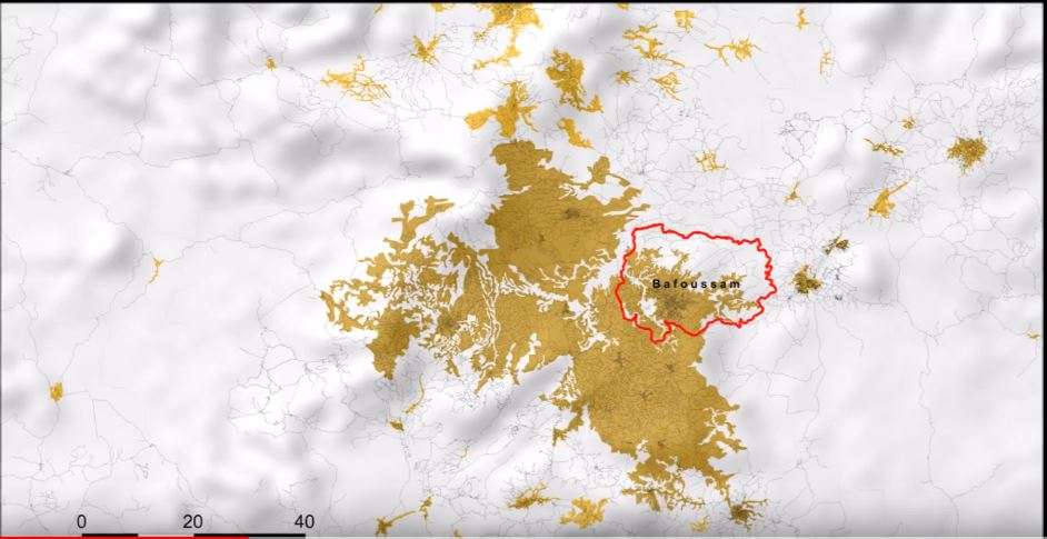
Since the early 2000s, the population of Bafoussam has been rapidly increasing. According to AFRICApolis project, led by e-GEOPOLIS, Bafoussam is the main centre of a Continuous Built-up Area which became a millionaire city in 2015 with a population of about 1,146,230 inhabitants.[11][12] This places Bafoussam as the third largest city in Cameroon after Yaounde and Douala.
Twin towns - Sister cities
Bafoussam is twinned with:
References
- "Presentation de la CUB". Communauté Urbaine de Bafoussam. Retrieved 28 April 2018.
- "Histoire de Bafoussam". Marie de Bafoussam 1er. Retrieved 26 February 2018.
- Toukam, Dieudonné (2010). Histoire et anthropologie du peuple bamiléké. L'Harmattan. p. 242.
- Toukam, Dieudonné (2008). Parlons bamiléké. Paris: L'Harmattan. p. 255.
- "Naissance et Évolution de la Ville de Bafoussam". Festival International du Cinema Independent de Bafoussam. 2017. Archived from the original on 18 September 2017. Retrieved 26 February 2018.
- Thomas Deltombe, Manuel Domergue, Jacob Tatsita, KAMERUN !, La Découverte, 2019
- "Climate: Bafoussam - Climate graph, Temperature graph, Climate table". Climate-Data.org. Archived from the original on 2013-12-03. Retrieved 2013-12-01.
- "Bafoussam, Cameroon". Voodoo Skies. Retrieved 2013-12-01.
- "Geographie physique de la ville de Bafoussam". Festival International du Cinema Independent de Bafoussam. Archived from the original on 27 February 2018. Retrieved 26 February 2018.
- "Classement des Etablissements de l'OBC". CRTV. 23 April 2018. Retrieved 10 May 2018.
- "Sahel and West Africa Club (SWAC/OECD)". AFRICApolis. 2015. Retrieved March 20, 2019.
- "Agglomeration of Bafoussam : urban or rural ?". YouTube. 2018. Retrieved March 20, 2019.
- "Les villes jumelles | Ville de Bayeux". Bayeux. Retrieved 26 February 2018.
| Wikivoyage has a travel guide for Bafoussam. |