Antares, Arizona
Antares is a village and census designated place (CDP) in Mohave County, Arizona. The CDP encompasses 0.65 square miles of land, and is at 3,556 feet elevation above sea level.[1] It exists on part of U.S. Route 66 in Arizona.
Antares | |
|---|---|
Village | |
.jpg) Tourist attractions in 2011 | |
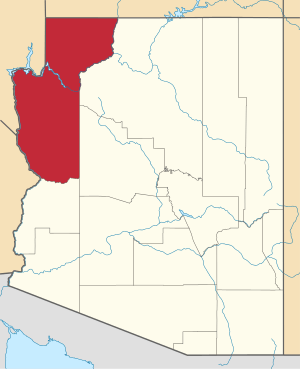
 Location of Antares in Arizona | |
| Coordinates: 35.4197°N 113.8086°W | |
| Area | |
| • Land | 0.65 sq mi (1.7 km2) |
| • Water | 0 sq mi (0 km2) |
| Elevation | 3,556 ft (1,084 m) |
| Population (2010) | |
| • Total | 126 |
| Time zone | UTC−07:00 (Mountain Standard Time) |
Etymology
Antares is named after the star Antares, in the constellation of Scorpio; the word is Greek and means "rival of Mars", given to the star because of its prominent red color.[2]
History
There are over 6,000 mine claims in and around Antares, of which 5,566 are closed.[3] There are 213 identifiable mines in the area, which primarily dug for copper, gold, lead, and silver.[4]
The village of Antares began as a railroad siding.[5] The Atlantic and Pacific Railroad was laying tracks through the area in 1883 and had to reroute around the Peacock Mountains, diverting south of the mountains to the easier gradient through nearby Hackberry; when continuing west, the gradient was lower in the Hualapai Valley six miles to the north of Hackberry, where Antares now lies. The railroad thus took a large curve to travel through this point down into Kingman. The siding built on the curve became incorporated as Antares after the National Old Trails Highway was constructed in 1910, following the railroad in this part of Arizona; when Route 66 was built in 1926 it also ran parallel to the railroad.[2] Antares was first recorded as a "town and railroad station" in the United States Geological Survey of 1923.[6]
Location

Antares is located in northwestern Arizona. Its boundary is marked by four roads, though it is not rectangular. The southern border follows State Route 66 and so curves, peaking near the center of the village. The eastern border is a roughly south–north road that is called Kingman Road south of Colorado Drive, and Kingman Drive north of this intersection. The western border runs parallel and is called Boulder Road. The village is bisected by Antares Road, which forms part of the northern border where California Drive, the west–east road at the village limit, staggers: the California Drive section from Boulder Road to Antares Road is slightly further south than East California Drive, which continues due east of the village until it reaches North Music Mountain Road. Only the eastern border road and California Drive west of Antares Road are entirely contained within Antares village limits. There are several other roads in the village, all named for nearby features and locations. The Valle Vista planned community is just west of the village.[7]
Most of the buildings in Antares lie to the west of Antares Road, though there are some in the southeast corner; the tourist spots in the center-south on Route 66; and a few buildings on the extension of Boulder Road that lies to the northwest of the village limits.[8] Mailboxes for the residents all lie at the Route 66-Antares Road intersection.[9]
.jpg)
Demographics
| Historical population | |||
|---|---|---|---|
| Census | Pop. | %± | |
| 2010 | 126 | — | |
| U.S. Decennial Census[10] | |||
Antares first appeared on the 2010 U.S. Census as a census-designated place (CDP). Of the 126 Antares residents as of 2010, 64 (50.8%) were male and 62 (49.2%) were female. The median age of its citizens was of 64.1 years at that time.[10] The majority of the population is white American, with a small number of Native Americans and no others.[11] The town's population density rated at 194.81 per square mile, ranking the town as #217 in population density. The city experienced a 17.65% decrease in population from 2006 to 2010.[12][13]
Climate
| Climate data for Truxton Canyon (Antares CDP), Arizona | |||||||||||||
|---|---|---|---|---|---|---|---|---|---|---|---|---|---|
| Month | Jan | Feb | Mar | Apr | May | Jun | Jul | Aug | Sep | Oct | Nov | Dec | Year |
| Average high °F (°C) | 53.5 (11.9) |
58.5 (14.7) |
64.2 (17.9) |
72.0 (22.2) |
81.1 (27.3) |
91.7 (33.2) |
96.4 (35.8) |
93.9 (34.4) |
87.8 (31.0) |
77.7 (25.4) |
65.4 (18.6) |
55.5 (13.1) |
74.8 (23.8) |
| Average low °F (°C) | 27.4 (−2.6) |
30.3 (−0.9) |
33.8 (1.0) |
39.5 (4.2) |
46.9 (8.3) |
55.3 (12.9) |
64.0 (17.8) |
62.3 (16.8) |
55.5 (13.1) |
44.7 (7.1) |
34.2 (1.2) |
28.1 (−2.2) |
43.5 (6.4) |
| Average precipitation inches (mm) | 1.05 (27) |
1.07 (27) |
0.97 (25) |
0.69 (18) |
0.29 (7.4) |
0.21 (5.3) |
1.27 (32) |
1.97 (50) |
1.13 (29) |
0.70 (18) |
0.56 (14) |
1.00 (25) |
10.91 (277.7) |
| Average snowfall inches (cm) | 1.1 (2.8) |
0.6 (1.5) |
0.5 (1.3) |
0.1 (0.25) |
0.0 (0.0) |
0.0 (0.0) |
0.0 (0.0) |
0.0 (0.0) |
0.0 (0.0) |
0.0 (0.0) |
0.2 (0.51) |
1.7 (4.3) |
4.2 (10.66) |
| Source: WRCC[14] | |||||||||||||
Transportation
Road and rail
.jpg)
Antares is along Route 66, which is the main road of the village.[2] The BNSF Railway runs parallel to Route 66.[15]
An unpaved side road called Antares Road and described as "fine for all vehicles" also runs through the Hualapai Valley.[15] Antares Road is a county road. It runs from Route 66 heading roughly northwest until it meets Pierce Ferry Road, giving access to Meadview, Arizona and the Colorado River at Lake Mead.[5] The U.S. Geological Survey says that "Antares Road is unpaved for 31 of the 32 miles; however, Mohave County does maintain the road to a native material standard."[16] Antares Road is designated County Highway 149, and after the intersection at Pierce Ferry Road it continues as County Highway 139/Gregg's Hideout Road.[17]
The part of Route 66 that runs through the village is a long curve. This curve, known as Antares Point, is the longest continuous curve on any United States Highway, running for about 2 mi (3.2 km).[18][19][20]
Air

The local airport, Music Mountain Air Ranch, operates two dirt runways, both of which had become overgrown by 2004.[21][22] Formerly Kingman Number 3 Army Airfield and also known as Hackberry Airfield, the airport is located off Antares Road just to the north of the village—the western runway intersects the road. Kingman Airport is the closest commercial airport, 15 miles west of Antares.[21][22][23] The Kingman Army Airfield had opened during World War II.[24] Bullhead City International Airport in Bullhead City is the closest international airport,[25] having formerly had charter flights to Canada, and is also relatively close. Phoenix Sky Harbor International Airport in Phoenix and McCarran International Airport in Las Vegas, Nevada are the closest large international airports to Antares.
Services
The Valle Vista District Fire Station #2 is located on Antares Road, half a mile north of State Route 66.[26] Some electrical services for the nearby Hualapai Indian reservation are connected on Antares Road.[16]
Tourism
.jpg)
The main destination in Antares is a camp park known both as Kozy Corner RV park[19] and Ranchero Motel.[5][27] The site also features the 'Giganticus Headicus' attraction, a 14-foot-tall (4.3 m) homemade monument resembling the Easter Island heads. The park is on the Antares Point curve.[18]
The RV park is isolated, bracketed between the Peacock Mountains and Route 66 and the Burlington Northern & Santa Fe Railway, which run parallel; it began as a camp for railroad workers in the early 1900s. A local legend claims that Gene Roddenberry stayed at the motel and named the Antares ship in Star Trek after its location.[19]
References
- "Antares, AZ Profile: Facts & Data". arizona.hometownlocator.com. Retrieved 2019-12-14.
- Whittall, Austin. "Antares, Arizona. Route 66: Attractions and Landmarks". www.theroute-66.com. Retrieved 2019-12-14.
- "Antares, Arizona Mining Claims And Mines". The Diggings™. Retrieved 2019-12-14.
- "Antares, Arizona Mines". The Diggings™. Retrieved 2019-12-14.
- Whittall, Austin. "Ranchero. Antares, Arizona. Route 66: Attractions and Landmarks". www.theroute-66.com. Retrieved 2019-12-14.
- Barnes, Will C. (1933). "ARIZONA PLACE NAMES* A Compilation of the Names of Arizona's Cities Villages and Settlements Early Stage and Modern Railroad Stations Its Mountains and Canyons, Lakes and Streams Springs and Desert Water Holes Long Forgotten Mining Towns Military Posts and Camps Their Origin, Meaning and History" (PDF). Arizona Historical Review. Arizona State Historian (Phoenix, AZ). 5: 300. ISSN 0748-2167.
- "Antares, AZ Profile: Map". arizona.hometownlocator.com. Retrieved 2019-12-18.
- "Antares, AZ Satellite Map". arizona.hometownlocator.com. Retrieved 2019-12-19.
- "Antares Road in Mohave County". mohavecountyhighways.com. Retrieved 2019-12-19.
- "Census of Population and Housing". Census.gov. Retrieved June 4, 2016.
- "Antares, Arizona Population". worldpopulationreview.com. Retrieved 2019-12-14.
- "Antares, AZ – USA.com™". www.usa.com. Retrieved 2019-12-14.
- "Antares, AZ Population and Races – USA.com™". www.usa.com. Retrieved 2019-12-14.
- "TRUXTON CANYON, ARIZONA (028778)". Western Regional Climate Center. Retrieved December 14, 2019.
- "Route 66, Arizona – Kingman to Williams". www.americansouthwest.net. Retrieved 2019-12-14.
- Davidson, Kevin; Randall, Mark; Isham, Tom; Horna, Marion J; Koronkiewicz, T; Simon, Rich; Rojas, Matthew; MacCourt, Doug C.; Burpo, Rob (December 2012). "Feasibility Report for Hualapai Tribe Wind Project". U.S. Department of Energy/Hualapai Tribal Nation Planning Department. doi:10.2172/1095901. OSTI 1095901 – via OSTI.
- Google (14 December 2019). "Antares Road/Co Hwy 149—Pierce Ferry Road/Co Hwy 25—Gregg's Hideout Road/Co Hwy 139 Intersection" (Map). Google Maps. Google. Retrieved 14 December 2019.
- "Giganticus Headicus at Antares Visitor Center". Go Kingman. Retrieved 2019-12-13.
- Hoekstra, Dave (2018). The Camper Book: A Celebration of a Moveable American Dream. Sall, Jon (1 ed.). Chicago, Illinois: Chicago Review Press. ISBN 978-1-61373-820-7. OCLC 1005192619.
- "20 Best Things to Do in Kingman, Arizona". VacationIdea. December 7, 2019. Retrieved 2019-12-14.
- "Abandoned & Little-Known Airfields: Northwestern Arizona". www.airfields-freeman.com. Retrieved 2019-12-14.
- "Music Mountain Air Ranch – United States". World Airport Codes. Retrieved 2019-12-14.
- "Antares". www.doney.net. Retrieved 2019-12-14.
- "Kingman Army Airfield Museum". kingmanhistoricdistrict.com. Retrieved 2019-12-19.
- "Antares Map | United States Google Satellite Maps". www.maplandia.com. Retrieved 2019-12-14.
- Ivanich, Paul A.; Conway, Brian D. (September 2009). "Preliminary Estimate of Groundwater in Storage for the Hualapai Valley Groundwater Basin Mohave County, Arizona" (PDF). Arizona Department of Water Resources Hydrology Division.
- "Route 66". www.californiaphotographyworkshops.com. Retrieved 2019-12-14.
External links
- Images of Antares Point at Route 66 Photos