Aloran, Misamis Occidental
Aloran, officially the Municipality of Aloran, is a 4th class municipality in the province of Misamis Occidental, Philippines. According to the 2015 census, it has a population of 27,625 people.[3]
Aloran | |
|---|---|
| Municipality of Aloran | |
 Municipal hall | |
 Seal | |
| Nickname(s): Heart of MisOcc | |
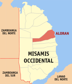 Map of Misamis Occidental with Aloran highlighted | |
OpenStreetMap 
| |
.svg.png) Aloran Location within the Philippines | |
| Coordinates: 8°24′53″N 123°49′22″E | |
| Country | |
| Region | Northern Mindanao (Region X) |
| Province | Misamis Occidental |
| District | 1st District |
| Founded | January 1, 1917 |
| Barangays | 38 (see Barangays) |
| Government | |
| • Type | Sangguniang Bayan |
| • Mayor | Junipher A. Roa |
| • Vice Mayor | Jimmy R. Regalado |
| • Congressman | Diego C. Ty |
| • Electorate | 21,277 voters (2019) |
| Area | |
| • Total | 118.06 km2 (45.58 sq mi) |
| Elevation | 12.3 m (40.4 ft) |
| Population (2015 census)[3] | |
| • Total | 27,625 |
| • Density | 230/km2 (610/sq mi) |
| • Households | 6,313 |
| Economy | |
| • Income class | 4th municipal income class |
| • Poverty incidence | 34.44% (2015)[4] |
| • Revenue (₱) | 85,233,359.94 (2016) |
| Time zone | UTC+8 (PST) |
| ZIP code | 7206 |
| PSGC | |
| IDD : area code | +63 (0)88 |
| Climate type | tropical climate |
| Native languages | Subanon language Cebuano Tagalog |
| Website | www |
Barangay
Aloran is politically subdivided into 38 barangays.
- Balintonga
- Banisilon
- Burgos
- Calube
- Caputol
- Casusan
- Conat
- Culpan
- Dalisay (Poblacion)
- Dullan,
- Ibabao (Poblacion)
- Tubod
- Labo
- Lawa-an
- Lobogon
- Lumbayao
- Makawa
- Manamong
- Matipaz
- Maular
- Mitazan
- Mohon
- Monterico
- Nabuna
- Palayan
- Pelong
- Ospital (poblacion)
- Roxas
- San Pedro
- Santa Ana
- Sinampongan
- Taguanao
- Tawi-tawi
- Toril
- Tuburan
- Zamora
- Macubon (Sina-ad)
- Tugaya
Climate
| Climate data for Aloran, Misamis Occidental | |||||||||||||
|---|---|---|---|---|---|---|---|---|---|---|---|---|---|
| Month | Jan | Feb | Mar | Apr | May | Jun | Jul | Aug | Sep | Oct | Nov | Dec | Year |
| Average high °C (°F) | 28 (82) |
28 (82) |
29 (84) |
31 (88) |
31 (88) |
30 (86) |
30 (86) |
30 (86) |
30 (86) |
30 (86) |
29 (84) |
28 (82) |
30 (85) |
| Average low °C (°F) | 23 (73) |
23 (73) |
23 (73) |
23 (73) |
24 (75) |
24 (75) |
24 (75) |
24 (75) |
24 (75) |
24 (75) |
24 (75) |
23 (73) |
24 (74) |
| Average precipitation mm (inches) | 69 (2.7) |
44 (1.7) |
37 (1.5) |
29 (1.1) |
87 (3.4) |
137 (5.4) |
131 (5.2) |
141 (5.6) |
143 (5.6) |
134 (5.3) |
68 (2.7) |
53 (2.1) |
1,073 (42.3) |
| Average rainy days | 9.9 | 7.6 | 7.4 | 8.1 | 21.6 | 26.5 | 26.4 | 26.6 | 25.8 | 24.3 | 15.1 | 10.4 | 209.7 |
| Source: Meteoblue [5] | |||||||||||||
Demographics
| Population census of Aloran | ||||||||||||||||||||||||||||||||||||||||||||||
|---|---|---|---|---|---|---|---|---|---|---|---|---|---|---|---|---|---|---|---|---|---|---|---|---|---|---|---|---|---|---|---|---|---|---|---|---|---|---|---|---|---|---|---|---|---|---|
|
| |||||||||||||||||||||||||||||||||||||||||||||
| Source: Philippine Statistics Authority[3][6][7][8] | ||||||||||||||||||||||||||||||||||||||||||||||
In the 2015 census, the population of Aloran, Misamis Occidental, was 27,625 people,[3] with a density of 230 inhabitants per square kilometre or 600 inhabitants per square mile.
Festival
"Bunga Dag Tabinal Festival" is held every September 21.
Gallery
 Municipal Plaza and Koi Pond
 Don Mariano Marcos Farmers' Training Center
 Rural Health Unit
 Lobogon Elementary School
References
- "Municipality". Quezon City, Philippines: Department of the Interior and Local Government. Retrieved 31 May 2013.
- "Province: Misamis Occidental". PSGC Interactive. Quezon City, Philippines: Philippine Statistics Authority. Retrieved 12 November 2016.
- Census of Population (2015). "Region X (Northern Mindanao)". Total Population by Province, City, Municipality and Barangay. PSA. Retrieved 20 June 2016.
- "PSA releases the 2015 Municipal and City Level Poverty Estimates". Quezon City, Philippines. Retrieved 12 October 2019.
- "Aloran: Average Temperatures and Rainfall". Meteoblue. Retrieved 29 April 2020.
- Census of Population and Housing (2010). "Region X (Northern Mindanao)". Total Population by Province, City, Municipality and Barangay. NSO. Retrieved 29 June 2016.
- Censuses of Population (1903–2007). "Region X (Northern Mindanao)". Table 1. Population Enumerated in Various Censuses by Province/Highly Urbanized City: 1903 to 2007. NSO.
- "Province of Misamis Occidental". Municipality Population Data. Local Water Utilities Administration Research Division. Retrieved 17 December 2016.
External links
| Wikimedia Commons has media related to Aloran, Misamis Occidental. |
- Aloran Profile at PhilAtlas.com
- Philippine Standard Geographic Code
- Philippine Census Information
- Local Governance Performance Management System
Places adjacent to Aloran, Misamis Occidental | |
|---|---|
This article is issued from Wikipedia. The text is licensed under Creative Commons - Attribution - Sharealike. Additional terms may apply for the media files.