Alden, Michigan
Alden is an unincorporated community and census-designated place (CDP) located in Helena Township in Antrim County in the U.S. state of Michigan. It is situated at the southeast end of Torch Lake, about 20 miles (32 km) northeast of Traverse City. The population of Alden was 125 at the 2010 census.[3]
Alden, Michigan | |
|---|---|
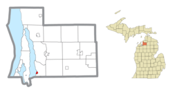 Location within Antrim County | |
 Alden Location within the state of Michigan | |
| Coordinates: 44°52′52″N 85°16′32″W | |
| Country | United States |
| State | Michigan |
| County | Antrim |
| Township | Helena |
| Settled | 1868 |
| Area | |
| • Total | 0.400 sq mi (1.04 km2) |
| • Land | 0.400 sq mi (1.04 km2) |
| • Water | 0.0 sq mi (0 km2) |
| Elevation | 604 ft (184 m) |
| Population | |
| • Total | 125 |
| • Density | 312.5/sq mi (120.7/km2) |
| Time zone | UTC-5 (Eastern (EST)) |
| • Summer (DST) | UTC-4 (EDT) |
| ZIP code(s) | 49615 (Bellaire) |
| Area code(s) | 231 |
| GNIS feature ID | 619916[2] |
Alden is at 44°52′52″N 85°16′32″W and the FIPS place code is 01060. The elevation is 604 feet (184 m) above sea level.[2] The Alden ZIP code 49612 serves portions of Helena Township as well as Custer Township to the east and Clearwater Township to the south and Rapid River Township to the south in Kalkaska County.[4]
The community first began to develop after a store was built in Helena Township in 1868. The settlement that formed around it was initially called Noble. Because it was located at the mouth of Spencer Creek, the community became known as Spencer Creek and received a post office with that name on June 15, 1869. After the Pere Marquette Railway came to the town in 1891, the post office was renamed Alden on July 18, 1892,[5] for William Alden Smith, who was an official with the railroad company.[6] Smith later became a congressman and U.S. senator from Michigan.
The community of Alden was listed as a newly-organized census-designated place for the 2010 census, meaning it now has officially defined boundaries and population statistics for the first time.[7]
References
- "2010 Census Gazetteer Files - Places: Michigan". U.S. Census Bureau. Retrieved May 5, 2018.
- U.S. Geological Survey Geographic Names Information System: Alden, Michigan
- "Geographic Identifiers: 2010 Demographic Profile Data (G001): Alden CDP, Michigan". U.S. Census Bureau, American Factfinder. Archived from the original on February 12, 2020. Retrieved June 10, 2013.
- 49612 5-Digit ZCTA, 496 3-Digit ZCTA - Reference Map - American FactFinder, U.S. Census Bureau, 2000 census
- U.S. Geological Survey Geographic Names Information System: Alden Post Office
- Romig, Walter (1986) [1973]. Michigan Place Names. Detroit, Michigan: Wayne State University Press. ISBN 0-8143-1838-X.
- "Michigan: 2010 Population and Housing Unit Counts 2010 Census of Population and Housing" (PDF). 2010 United States Census. United States Census Bureau. September 2012. p. III-4. Retrieved January 21, 2020.
External links
Municipalities and communities of Antrim County, Michigan, United States | ||
|---|---|---|
| Villages | 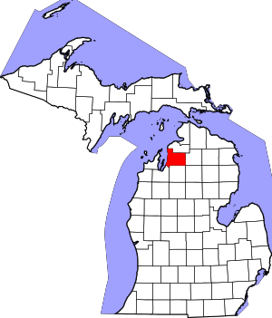 Map of Michigan highlighting Antrim County.svg | |
| Civil townships | ||
| CDPs | ||
| Other unincorporated communities | ||
| Indian reservation | ||
| Footnotes | ‡This populated place also has portions in an adjacent county or counties | |
| Authority control |
|
|---|