Al-Taybah
Al-Tayba (Arabic: الطيبة, also spelled Tayyiba or Tayibah) is a village in eastern Syria, administratively part of the Homs Governorate. It is located in the Syrian Desert, near the Euphrates River to the east and al-Sukhnah and the village of al-Kawm to the west. Like many of the other desert towns in Syria, it is situated in a spring-fed oasis. According to the Central Bureau of Statistics (CBS), al-Taybah had a population of 2,413 in the 2004 census.[1]
Al-Tayba الطيبة Tayyiba | |
|---|---|
Village | |
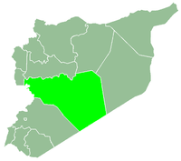
 Al-Tayba Location in Syria | |
| Coordinates: 35°5′16″N 38°54′46″E | |
| Country | |
| Governorate | Homs Governorate |
| District | Tadmur District |
| Nahiyah | Al-Sukhnah |
| Population (2004) | |
| • Total | 2,413 |
| Time zone | UTC+3 (EET) |
| • Summer (DST) | UTC+2 (EEST) |
History
Al-Taybah is an Arabic name meaning "the Good."[2] In the early 13th-century Syrian geographer Yaqut al-Hamawi noted al-Taybah was a "village in the district of 'Urd, lying between Palmyra and Aleppo."[3]
Al-Taybah was visited in 1616 by Italian explorer Pietro Della Valle, who noted that the presence of several "old relics" in the village. The mosque was well-maintained and appeared to have previously served as a church tower. Residences consisted of mud huts, many of which were reinforced by ancient stone columns.[2]
The village was abandoned sometime in the 18th century with its inhabitants migrating to nearby al-Sukhnah. The modern-day settlement was founded in 1870 after one of the descendants of the 17th-century emigrants from al-Taybah and a resident of al-Sukhnah obtained permission by the governor of the Sanjak of Zor (Deir ez-Zor). He established the new village with ten or twelve other families. The Ottomans set up a gendarmerie post there afterward.[4] In 1838 al-Taybah was classified as an abandoned village by English scholar Eli Smith.[5]
At some point between 1914 and 1918, during World War I when Ottoman authority in Syria was being challenged, al-Taybah was raided and looted by Bedouin tribesmen from the area, resulting in a second exodus of the village's residents. It was reoccupied during French Mandate rule which restored a level of security in al-Taybah.[4]
During the Syrian Civil war, the Islamic State of Iraq and the Levant (ISIL) captured the village.[6] However, in 20/08/2017, the Army stormed the Taybah area from their positions at the Al-Kawm axis, pushing their way through ISIL's front-lines. Unable to maintain their positions, ISIL was forced to retreat from Taybah, leaving the entire area for the Army to take control of after a short battle.[7]
References
- General Census of Population and Housing 2004. Syria Central Bureau of Statistics (CBS). Homs Governorate. (in Arabic)
- Musil, 1928, p. 76.
- le Strange, p. 545.
- Mundy and Musallam, p. 42.
- Smith, 1841, p. 174.
- ISIS expands hold in Syria with control of Palmyra ruins
- Syrian Army liberates important area to besiege ISIL north of Palmyra, Al-Masdar news, 20/08/2017.
Bibliography
- Mundy, Martha; Musallam, Basim (2000). Transformation of Nomadic Society in the Arab East. Cambridge University Press. ISBN 0-521-77057-2..
- Musil, Aloise (1928). Palmyrena: A Topographical Itinerary. American Geographical Society..
- le Strange, Guy (1890). Palestine Under the Moslems: A Description of Syria and the Holy Land from A.D. 650 to 1500. Committee of the Palestine Exploration Fund. p. 493.
Lajjun Guy le Strange.
. - Smith, Eli; Robinson, Edward (1841). Biblical Researches in Palestine, Mount Sinai and Arabia Petraea: A Journal of Travels in the Year 1838. 3. Crocker and Brewster.
|  | |||||||||||||||||||||||||||||
|
| ||||||||||||||||||||||||||||||
| ||||||||||||||||||||||||||||||
| ||||||||||||||||||||||||||||||
| ||||||||||||||||||||||||||||||