Abil
Abil (Arabic: آبل, also spelled Abel or Aabel) is a village in central Syria, administratively part of the Homs Governorate, located 10 kilometers south of Homs. Nearby localities include al-Nuqayrah and Kafr Aya to the north, Maskanah to the northeast, Judaydat al-Sharqiyah to the east, Shinshar to the southeast, Damina al-Sharqiyah to the south, al-Buwaydah al-Sharqiyah to the southwest and Qattinah to the west. According to the Syria Central Bureau of Statistics (CBS), Abil had a population of 2,873 in the 2004 census.[1] Its inhabitants are predominantly Sunni Muslims.[2]
Abil آبل Abel | |
|---|---|
Village | |
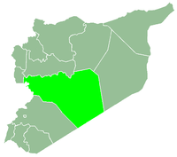
 Abil Location in Syria | |
| Coordinates: 34°38′14″N 36°40′34″E | |
| Country | |
| Governorate | Homs |
| District | Homs |
| Subdistrict | Homs |
| Population (2004) | |
| • Total | 2,873 |
Abil is identified the Roman era settlement of Abila Lysaniae.[3] The medieval Syrian geographer Yaqut al-Hamawi visited the village in the 1220s, noting it was "A village of Hims, lying near the city, to the south, and about 2 miles distant."[4]
References
- General Census of Population and Housing 2004 Archived 2012-07-31 at Archive.today. Syria Central Bureau of Statistics (CBS). Homs Governorate. (in Arabic)
- Smith, 1841, p. 176.
- Lipinski, 2000, p. 250.
- le Strange, 1890, p. 381.
Bibliography
- Lipinsky, Edward (2000). The Aramaeans: Their Ancient History, Culture, Religion. Peeters Publishers. ISBN 9042908599.
- Smith, Eli; Robinson, Edward (1841). Biblical Researches in Palestine, Mount Sinai and Arabia Petraea: A Journal of Travels in the Year 1838. 3. Crocker and Brewster.
- le Strange, Guy (1890). Palestine Under the Moslems: A Description of Syria and the Holy Land from A.D. 650 to 1500. Committee of the Palestine Exploration Fund.
|  | |||||||||||||||||||||||||||||
|
| ||||||||||||||||||||||||||||||
| ||||||||||||||||||||||||||||||
| ||||||||||||||||||||||||||||||
| ||||||||||||||||||||||||||||||