Al-Dabaah
Al-Dabaah (Arabic: الضبعة, also spelled Daba'a) is a village in central Syria, administratively part of the Homs Governorate, located southwest of Homs. Nearby localities include Arjoun to the west, Kafr Mousa and al-Ghassaniyah to the northwest, Daminah al-Gharbiyah to the north, al-Buwaydah al-Sharqiyah and Daminah al-Sharqiyah to the northeast, Shamsin to the east and Jandar to the southeast. According to the Syria Central Bureau of Statistics (CBS), al-Dabaah had a population of 3,129 in the 2004 census.[1]
Al-Dabaah الضبعة Al-Dab'ah | |
|---|---|
Village | |
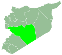
 Al-Dabaah Location in Syria | |
| Coordinates: 34°33′9″N 36°36′44″E | |
| Country | |
| Governorate | Homs |
| District | Al-Qusayr |
| Subdistrict | Al-Qusayr |
| Population (2004) | |
| • Total | 3,129 |
| Time zone | UTC+3 (EET) |
| • Summer (DST) | UTC+2 (EEST) |
References
- General Census of Population and Housing 2004 Archived 2012-12-04 at Archive.today. Syria Central Bureau of Statistics (CBS). Homs Governorate. (in Arabic)
|  | |||||||||||||||||||||||||||||
|
| ||||||||||||||||||||||||||||||
| ||||||||||||||||||||||||||||||
| ||||||||||||||||||||||||||||||
| ||||||||||||||||||||||||||||||
This article is issued from Wikipedia. The text is licensed under Creative Commons - Attribution - Sharealike. Additional terms may apply for the media files.