Acatlán de Juárez
Acatlán de Juárez is a town and municipality, in Jalisco in central-western Mexico. The municipality covers an area of 166.68 km².
Acatlán de Juárez | |
|---|---|
Municipality and city | |
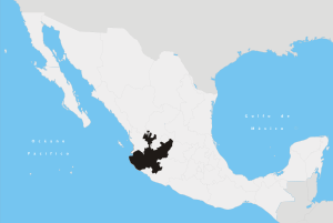
 Location of the municipality in Jalisco | |
Acatlán de Juárez Location in Mexico | |
| Coordinates: 20°14′N 103°32′W | |
| Country | |
| State | Jalisco |
| Area | |
| • Total | 166.68 km2 (64.36 sq mi) |
| Elevation | 1,393 m (4,570 ft) |
| Population (2005) | |
| • Total | 22,540 |
As of 2005, the municipality had a total population of 22,540.[1]
History
The first settlers in the region were members of a tribe that was established in Cocula, They were defeated by the Purepecha in 1509.
In the year of 1550 the area for the first time attained the first level of a municipality, under the power of the viceroy of the New Spain, Antonio de Mendoza.[1] During his rule he encountered discontent with people in Zacoalco de Torres, Ahualulco and Ameca. In the first half of the 17th century the Augustinians built a temple dedicated to Santa Ana, known today as the " Parroquia de Santa Ana".
In 1825 the area fell under the canton of Sayula. In 1858, Benito Juárez, in his journey through these lands, stayed at the inn in the town of Acatlán de Juárez, owned by Miguel Gomez. During his short stay, he was killed at the hands of the conservatives, and died saving the pastor of the place, Meliton Gutierrez Vargas.[1] On March 22 of 1906, by decree 1158, the name of the earlier village changed its name from Santa Ana Acatlan to Acaltán de Juarez, and acquired the title of a town.[1]
Geography
Acatlán de Juárez is located in the centre of Jalisco state between the coordinates 20° 14'30" north latitude and 103° 32'30" west longitude at an altitude of 1,393 metres above sea level.
The municipality is bordered on the north by the municipalities of Tala and Tlajomulco de Zuñiga, to the east by the municipalities of Tlajomulco de Zuñiga, Jocotepec and Zacoalco de Torres to the south with the municipalities of Zacoalco de Torres and Villa Corona, and to the west by the municipalities of Villa Corona and Tala.
Approximately 57% of the land area is flat, especially in the middle east, west and south of the municipality with its characteristic valleys. The primary agricultural areas at some 39% are located to the north and east, with altitudes of 1,400 and 1,500 m. There are some hilly areas accounting for just 4% of the land area which lies to the south-east and north-west at altitudes that reach the 2.200 m.
The municipality belongs to the hydrological basin known as Lerma-Chapala-Santiago.[2] Its water resources are provided by the Acatlán River and the springs El Cajón del Muerto and Charco Verde.[1] In addition, several small streams flow in the rainy season, the Hurtado, Presa Chica and Bordo de San Gerardo.
The climate is dry with a dry winter and spring, semi-warm in the winter season. The average annual temperature is 20.5 °C, with an average annual rainfall of 714.7 mm and can reach up to 1.100, with the heaviest rainfall in July and August. Prevailing winds flow in the easterly direction.
Economy
Agriculture is the primary activity in the municipality, with crops such as sugarcane, maize, beans, peanuts, sunflower and tomato.[1] Livestock is also a main economic activity with the rearing of cattle, swine, sheep, goats, horses, rabbits and hives. Sugar and alcohol production are of note.[1] The town has a wide variety of commercial establishments and provides services to tourists.[1]
Government
The form of government is democratic under the state and Federal elections are held every 3 years, which elects the mayor and his cabinet. The current mayor is Luis Carrillo Bueno, an activist of the Mexican Labor Party, and was elected in the elections of July 2 of 2006.[3]
The municipality has 27 villages, the most important Acatlan de Juárez (town), Bellavista, El Plan, San Jose de los Pozos, San Pedro Valencia, and Villa de los Niños.
Culture
 |
 |
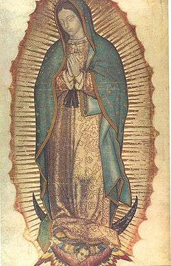
| Our Lady of Guadalupe | Juan Diego |
|---|
Much of the architecture in the municipality is stone work dating back to the 1850s. The town contains the "Benito Juárez" arts and crafts museum. A religious festival is celebrated on July 26 n honor of St. Anne, the patron saint of the city.[1] It is customary on December 11 each year to also light bonfires at night along the streets, to commemorate the vision of Our Lady of Guadalupe to Juan Diego.[1]
Local cuisine includes the Birria goat, Carnitas beef, pork and beans and sweets known as Encalada flour fritters and ponteduro.[1] Guarapo, a fruit cane juice and fruit punch are common beverages.
Notable landmarks
Architecture
- Parroquia de Santa Ana
- Museo de Artes y Oficios
- Chorros de Santa Ana
- Mesón de la Providencia
- Museo Benito Juárez
- Panteón Municipal
Parks and reserves
- Cerro de la Coronilla
- Mirador de Santa Cruz
- Cerro de la Lima
- Paseo del Río
- Presa del Hurtado
Notable people
- Joaquín Baeza Agraz – doctor
- Francisco Melitón Vargas – pastor
- Ismael Baeza – writer
- Miguel Baeza Agraz – writer
- Basilio Rueda Guzmán
- Carlos Augusto Ortiz – athlete
- Jesús Huerta Leal, polítician
- Nayar Carrillo, writer
- Bruno Romero, Philanthropist
References
- "Acatlán de Juárez". Enciclopedia de los Municipios de México (in Spanish). Instituto Nacional para el Federalismo y el Desarrollo Municipal. Archived from the original on May 28, 2007. Retrieved April 13, 2009.
- "Mapa de Regiones Hidrológicas" (in Spanish). INEGI. 2008. Archived from the original on 2009-06-12. Retrieved May 10, 2009.
- "List of Presidents Elected Municipal" (PDF) (in Spanish). IEEJ. 2006. Retrieved May 10, 2009.