Huejúcar
Huejúcar is a town and municipality, in Jalisco in central-western Mexico. The municipality covers an area of 550.23 km².
Huejúcar | |
|---|---|
Municipality and city | |
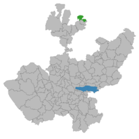 Location of the municipality in Jalisco | |
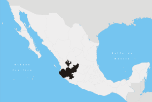
Huejúcar Location in Mexico | |
| Coordinates: 23°31′N 103°01′W | |
| Country | |
| State | |
| Municipality | Huejúcar |
| Government | |
| • Type | Ayuntamiento |
| • Municipal President | Alvaro Garcia |
| • Alcalde | Felipe Aquino Gomez |
| • Secretary-General | Fernando Banuelos Meza |
| • Municipal Judge | Carlos Alejandro Flores Marquez |
| Area | |
| • Total | 550.23 km2 (212.44 sq mi) |
| Elevation | 1,750-2,600 m (5,741-8,530 ft) |
| Population (2010) | |
| • Total | 6,084 [1] |
| Time zone | UTC-6 (Central) |
| • Summer (DST) | UTC-5 (Central) |
| Website | http://www.huejucar.jalisco.gob.mx/index.html |

As of 2010, the municipality had a total population of 6,084.
The name Huejúcar means "Place of Willows" in Nahuatl. It is about 240 km from the state capital, Guadalajara. It is next to Santa María de los Ángeles and Tepetongo. The municipality borders with the state of Zacatecas.
The city of Huejucar can trace its history back beyond the creation of Nueva Galicia in the Viceroyalty of New Spain. In 1530, Pedro Almíndez Chirinos passed through and conquered the area in the name of Spain during his voyage from Cuitzeo, Michoacan to Tepic, Nayarit. [2] On March 13, 1837, a decree is made that Huejucar would become part of the Colotlan Municipality. Later, on November 9, 1861, Huejucar would become its own municipality and twelve years later on September 24, 1873 would receive the title of Villa.
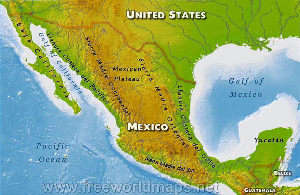
The town of Huejucar, although its average elevation is higher than that of the alpine city of Denver, Colorado in the United States, it is in a semiarid region with monsoonal weather in the summer months (July and August, mostly) with an average rainfall of 530.30mm (20.88 inches) of rainfall per year and an average temperature of 17.4C (63.3F). Summer months can reach highs on average of 38.3C (100.9F) while winter months reach lows on average of 0.8C (33.4F). Due to the Sierra Madre Occidental Mountains to the west, winds usually gust from the northeast. The town has average elevation of about 2,000 meters (6,562 feet) and the municipality's elevation varies drastically to as low as 1,750 meters (5,741 feet) in the valleys and as high as 2,600 meters (8,530 feet) in its mountainous areas on the western end of the municipality along the Sierra Madre Occidental Mountains. Hydrothermal streams and ponds dot the landscape to the west while the east and northeastern areas lead into the vast Mexican Plateau region in between the Sierra Madre Occidental and Oriental regions [3] .
Mexican Federal Highway 23 runs north-south which connects Huejucar on the southern terminus to the metropolitan area of Guadalajara, Jalisco and on its northern terminus to Fresnillo, Zacatecas.
References
External links