Aalma ech Chaab
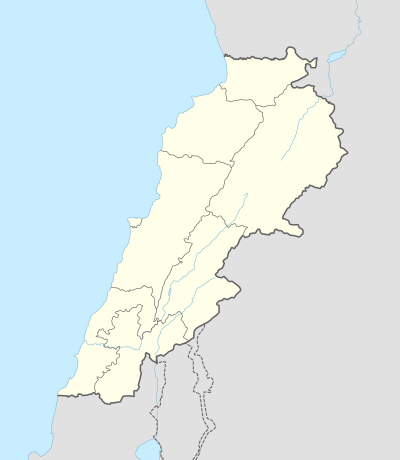
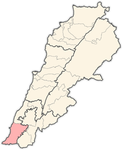
Aalma ech Chaab (علما الشعب) is a village in the Tyre District, in Southern Lebanon.
Aalma ech Chaab علما الشعب Alma ash-Shab | |
|---|---|
Village | |
 Aalma ech Chaab | |
| Coordinates: 33°06′18.4″N 35°10′15.6″E | |
| Grid position | 167/278 PAL |
| Country | |
| Governorate | South Governorate |
| District | Tyre |
| Highest elevation | 1,250 ft (380 m) |
| Time zone | GMT +3 |
Name
According to E. H. Palmer, ’Alma means "a coat of mail"; while Shảub means "mountain spurs".[1]
History
In 1875, during the late Ottoman era, Victor Guérin found here a village with 350 inhabitants, mostly Greek Orthodox, or Maronite.[2]
In 1881, the PEF's Survey of Western Palestine (SWP) described it: “A large Christian village, containing about 500 inhabitants. The houses are clean and well built. There are two chapels, and the place seems increasing in size. It is situated on a ridge, with figs, olives, and pomegranates and arable land around. To the east and north the land is covered with brushwood. There is a spring within reach, and about thirty rock-cut cisterns in the village.”[3]
Bibliography
- Conder, C.R.; Kitchener, H.H. (1881). The Survey of Western Palestine: Memoirs of the Topography, Orography, Hydrography, and Archaeology. 1. London: Committee of the Palestine Exploration Fund.
- Guérin, V. (1880). Description Géographique Historique et Archéologique de la Palestine (in French). 3: Galilee, pt. 2. Paris: L'Imprimerie Nationale.
- Palmer, E.H. (1881). The Survey of Western Palestine: Arabic and English Name Lists Collected During the Survey by Lieutenants Conder and Kitchener, R. E. Transliterated and Explained by E.H. Palmer. Committee of the Palestine Exploration Fund.
External links
- Aalma ech Chaab, Localiban
- Survey of Western Palestine, Map 3: IAA, Wikimedia commons
Capital: Tyre | ||
| Towns and villages |
|  |
| Palestinian refugee camps | ||
| Other | ||