Zemunski Kej
| Zemunski Kej Земунски Кеј | |
|---|---|
| Urban neighbourhood | |
.JPG) Zemunski Kej | |
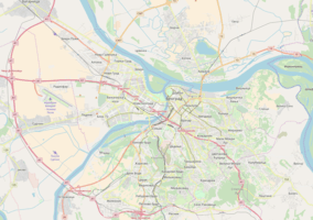 Zemunski Kej Location within Belgrade | |
| Coordinates: 44°50′36″N 20°25′02″E / 44.84333°N 20.41722°ECoordinates: 44°50′36″N 20°25′02″E / 44.84333°N 20.41722°E | |
| Country |
|
| Region | Belgrade |
| Municipality | Zemun |
| Time zone | UTC+1 (CET) |
| • Summer (DST) | UTC+2 (CEST) |
| Area code | +381(0)11 |
| Car plates | BG |
Zemunski Kej (Serbian Cyrillic: Земунски Кеј) is an urban neighborhood of Belgrade, the capital of Serbia. It is located in Belgrade's municipality of Zemun.
Location

Zemunski Kej, as its name suggests (Zemun's quay), is located alongside the right bank of the Danube. The promenade itself (officially named Kej Oslobođenja, Quay of Liberation) begins below the Gardoš hill, at the square of Veliki Trg and after 2, 5 kilometers it continues into the municipality of Novi Beograd. On the east it borders the neighborhoods of Donji Grad and Retenzija and on the south the neighborhood of Ušće in Novi Beograd.
Promenade
Modern area of Zemun's Donji Grad was regularly flooded by the Danube. After massive 1876 floods, local authorities began the construction of the stony levee along the Danube's bank. Levee, a kilometer long, was finished in 1889.[1] When hydroelectrical plant Đerdap I began to fill its reservoir in the late 1960's, due to the backwater of the Danube, underground waters in Zemun and New Belegrade got elevated and the cellars of the buildings got flooded. To prevent this, the high embankment with the promenade was built in 1967 so the Danube rarely flooded the quay (most notably in 1981).[2] In September 2007 reconstruction of the quay’s 350 meters long section began including further elevation of the embankment, widening of the pedestrian path and construction another one on separate level, completion of the cycling path, etc. Works, which were the first works on any embankments in Belgrade since 1990, were finished in 2008.[3][4] Works continued in 2010-2011. After being elevated by one meter in 1967 to the point 70.5 meters, embankment was further raised to the points 73.5 in 2010 and 77 in 2011, thus preventing any further floodings as the recorded water level was never higher than that. Over 450 meters of the embankment was first solidified with 17,000 m3 of different materials, then consolidated with beams and further elevated with 20,000 m3 of sand, gravel and stone.[5]
Characteristics
For the most part, the promenade is parallel to the street opened for traffic. Near the beginning of the promenade is one of major roundabouts in Zemun, with terminal bus stops for many public transportation bus lines (82, 85, 610, 611, 705). The promenade continues around Ušće and makes one continuous pedestrian path next to the neighborhoods of Staro Sajmište and Savski Nasip, alongside the left bank of the Sava.
As the bank (and thus the quay, too) follows the line of the nearby Great War Island, it is the beginning point of the pontoon bridge which seasonally connects the Lido beach on the island with the mainland.[6][7]
Zemunski Kej is the main Zemun's landing area for numerous boats. In April 2018 it was announced that the pier for the touristic ships and cruisers will be built on the quay. It will be constructed near the Old Port Authorty (Stara Kapetanija) where the old Zemun port was located. Designed to accept ships up to 120 m (390 ft) long and 15 m (49 ft) wide, the project should be finished by the 2019 nautical season.[8] It will be the second international touristic pier in Belgrade, after the one in Savamala neighborhood, on the Sava river. A steel pontoon, 50 m (160 ft) long and 4 m (13 ft) wide, will serve for the boarding and disembarkation of the visitors.[9]
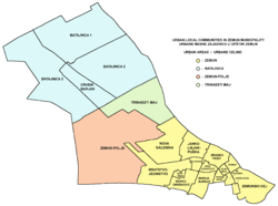
Zemunski Kej makes a local community (mesna zajednica, municipal sub-administrative division) within the municipality of Zemun, with a population of only 3,649 by the 2002 census of population.[10] This is because lots of area in the neighborhood are pedestrian paths or green areas used for recreation (including a large seasonal amusement park) and commercial facilities. The residential areas include blocks 9-a and 11-c. One of the largest hotels in Belgrade, "Hotel Jugoslavija" is located in the neighborhood, but it has been closed since the NATO bombing of Serbia in 1999 when it was badly damaged. It was opened partially in 2007 as the largest casino in Belgrade. The bank in front of the hotel is a location of many restaurants and clubs on barges (Serbian: splav), one of the focal points of the vibrant Belgrade's nightlife.
It is also location of several old and famous kafanas in Zemun, like Venecija, Stara Kapetanija, Šaran, etc.
References
- ↑ Miloje Jovanović Miki (2 December 2010). "Brdo Gardoš nije brdo" (in Serbian). Politika. Archived from the original on 31 May 2016.
- ↑ I.Ješić (8 April 2009). "Podzemne vode više ne prete Paviljonima" (in Serbian). Politika.
- ↑ Politika daily, September 27, 2007, p.26
- ↑ "Sanacija obaloutvrda sa pristanom na delu Zemunskog keja" (in Serbian). Građevinarstvo.rs. 30 July 2010.
- ↑ V.V., "Zemun se štiti od stogodišnjih voda", Politika (in Serbian)
- ↑ D.Mojić (3 July 2008), "Počelo leto na Lidu" [Summer at Lido began], Glas javnosti (in Serbian)
- ↑ N.M. (1 July 2008), "Sezona na Lidu od sutra" [Season on Lido starts tomorrow], Politika (in Serbian), p. 24
- ↑ Beta agency (24 April 2018). "Turistički kruzeri od sledeće sezone pristaju u Zemun" [Touristic cruisers will stop at Zemun from the next season]. Večernje Novosti (in Serbian).
- ↑ Ana Vuković (26 April 2018). "Крузери ће пристајати у Земуну" [Cruisers will stop in Zemun]. Politika (in Serbian). p. 15.
- ↑ Popis stanovništva po mesnim zajednicama, Saopštenje 40/2002, page 4. Zavod za informatiku i statistiku grada Beograda. 26 July 2002.