Zalaszentgrót
| Zalaszentgrót | ||
|---|---|---|
| ||
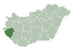
 Zalaszentgrót Location of Zalaszentgrót | ||
| Coordinates: 46°56′25″N 17°04′53″E / 46.94040°N 17.08138°ECoordinates: 46°56′25″N 17°04′53″E / 46.94040°N 17.08138°E | ||
| Country |
| |
| County | Zala County | |
| Area | ||
| • Total | 81.62 km2 (31.51 sq mi) | |
| Population (2004) | ||
| • Total | 7,875 | |
| • Density | 96.48/km2 (249.9/sq mi) | |
| Time zone | UTC+1 (CET) | |
| • Summer (DST) | UTC+2 (CEST) | |
| Postal code | 8790 | |
| Area code(s) | 83 | |

Twin towns — sister cities
Zalaszentgrót is twinned with:

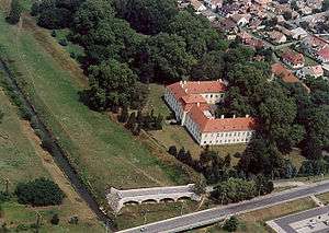
Aerialphotography of Zalaszentgrót
External links
- Street map (in Hungarian)
.svg.png)
This article is issued from
Wikipedia.
The text is licensed under Creative Commons - Attribution - Sharealike.
Additional terms may apply for the media files.