Yongchang County
| Yongchang County 永昌县 | |
|---|---|
| County | |
.jpg) Rural area of Yongchang County | |
 Location in Jinchang | |
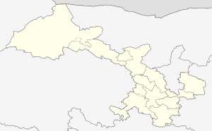 Yongchang Location of the seat in Gansu | |
| Coordinates: 38°16′48″N 102°07′12″E / 38.28000°N 102.12000°ECoordinates: 38°16′48″N 102°07′12″E / 38.28000°N 102.12000°E | |
| Country | People's Republic of China |
| Province | Gansu |
| Prefecture-level city | Jinchang |
| Township-level Divisions | 10 township-level divisions |
| Population (2010)[1] | 235,489 |
| Time zone | UTC+8 (China Standard) |
| Website |
www |
Yongchang County (Chinese: 永昌县; pinyin: Yǒngchāng Xiàn) is a county located in the southern half of the prefecture-level city of Jinchang in the north-central part of Gansu province, China. It has been associated with the historical Liqian and Fanhe counties. The village of Zhelaizhai, located in Jiaojiazhuang township, has been the subject of international academic and media attention for its potential connection to Sino-Roman relations.
History
The ancient Northern Silk Road passes through Yongchang County; numerous Han envoys were sent west along this trackway, some parties exceeding 100 members, late in the first millennium BC. The Han dynasty sent one mission to Parthia, which was reciprocated around 100 BC: Roman emissaries were captured by the Chinese in 30 BC along the Silk Road at Yongchang.[2]
At various times during the 20th century and early 21st century, the county has entered the sight of media because some of the inhabitants of Jiaojiazhuang township's Liqian village (骊靬村) (Zhelaizhai), located where the ancient Liqian county had existed in the early imperial period (Western Han dynasty to Sui dynasty), have been theorized to be descendants of a Roman legion.[3] Although this story has been seized upon by enthusiastic Chinese of the area and non-specialist Westerners, at least two eminent Chinese authorities have shown that the notion has serious shortcomings.[4][5][6][7]
Administrative divisions
In 1996, Yongchang County was made up of four towns and six townships. In 2000, Dongzhai township and Shuiyuan township both became towns. Since that change, Yongchang County has been made up of the following six towns and four townships:[1][8][9][10]
Six towns:
Four townships:
Transport
Gallery
.jpg) Local mural
Local mural.jpg) Local landscape
Local landscape.jpg) Yongchang Service Area (永昌服务区)
Yongchang Service Area (永昌服务区).jpg) Local landscape
Local landscape
References
- 1 2 "永昌县历史沿革" [Yongchang County History] (in Chinese). 行政区划网(区划地名网)/Administrative Division Network (District Geographic Names Network). 17 June 2016. Retrieved 11 May 2018.
1996年,永昌县{...}辖4个镇、6个乡{...}2000年,东寨乡、水源乡撤乡设镇。至此,永昌县辖6个镇、4个乡。{...}六坝乡{...}2010年第六次人口普查,永昌县常住总人口235489人,其中,城关镇55437人,河西堡镇47395人,新城子镇20624人,朱王堡镇26419人,东寨镇11848人,水源镇16825人,红山窑乡25416人,焦家庄乡15635人,六顼[sic]乡12069人,南坝乡3821人。
- ↑ Hogan, C. Michael (19 November 2007). "Silk Road, North China - Ancient Trackway in China". The Megalithic Portal.
- ↑ Yuping, Cao (May 2007). 者来寨里的“欧洲”村民. China's Ethnic Groups (in Chinese). Ethnic Groups Unity Publishing House: 52&ndash, 53.
- ↑ Hoh, Erling (14 January 1999). "Lost Legion". Far Eastern Economic Review. pp. 60&ndash, 62.
- ↑ "Do descendants of Roman soldiers live in Gansu?". China Daily. 21 July 1998.
- ↑ Ying-shih, Yu (1967). Trade and Expansion in Han China: A Study in the Structure of Sino-Barbarian Economic Relations. Berkeley: University of California Press. pp. 89–91.
- ↑ I-tien, Hsing (1997). 漢代中國與羅馬帝國關係的再檢討 (1985-95) [Relations between Han China and the Roman Empire Revisited (1985-95)]. Chinese Studies (
漢學研究) (in Chinese). 15 (1): 1&ndash, 31. templatestyles stripmarker in
|journal=at position 18 (help) - ↑ "2016年统计用区划代码和城乡划分代码:永昌县" [2016 Statistical Area Numbers and Rural-Urban Area Numbers: Yongchang County] (in Chinese). 中华人民共和国国家统计局 (National Bureau of Statistics of the People's Republic of China). 2016. Retrieved 11 May 2018.
统计用区划代码 名称 620321100000 城关镇 620321101000 河西堡镇 620321102000 新城子镇 620321103000 朱王堡镇 620321104000 东寨镇 620321105000 水源镇 620321200000 红山窑乡 620321201000 焦家庄乡 620321202000 六坝乡 620321203000 南坝乡
- ↑ "走进永昌-中国永昌" [Enter Yongchang - Yongchang, China]. “中国·永昌“门户网站 (in Chinese). 永昌县人民政府 永昌县信息中心. Retrieved 11 May 2018.
新城子镇 红山窑乡 焦家庄乡 城关镇 东寨镇 六坝乡 南坝乡 水源镇 朱王堡镇 河西堡镇
- ↑ "Yongchang". Google Maps. Retrieved 13 May 2018.
External links
