Yokohl Valley, California
Coordinates: 36°17′24″N 119°04′12″W / 36.29000°N 119.07000°W
| Yokohl Valley | |
|---|---|
| Unincorporated community | |
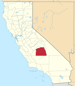
 Yokohl Valley Location in California  Yokohl Valley Yokohl Valley (the US) | |
| Coordinates: 36°17′24″N 119°04′12″W / 36.29000°N 119.07000°W | |
| Country | United States |
| State | California |
| County | Tulare County |
| Elevation[1] | 463 ft (141 m) |
Yokohl Valley is an unincorporated community in Tulare County, California. It lies at an elevation of 463 feet (141 m). Currently, the Yokohl Valley area constitutes the most eastern part of Exeter, CA along the foothills. Yokohl Valley may be reached through Rocky Hill Rd from the west, Myer Dr from the south and Yokoh l Dr from the north off CA Hwy 198.
References
This article is issued from
Wikipedia.
The text is licensed under Creative Commons - Attribution - Sharealike.
Additional terms may apply for the media files.