Angiola, California
| Angiola, California | |
|---|---|
| Unincorporated community | |
 Angiola, California | |
| Coordinates: 35°59′21″N 119°28′33″W / 35.98917°N 119.47583°WCoordinates: 35°59′21″N 119°28′33″W / 35.98917°N 119.47583°W | |
| Country | United States |
| State | California |
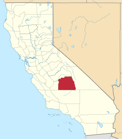
| County | Tulare |
| Elevation | 203 ft (62 m) |
| Time zone | UTC-8 (Pacific (PST)) |
| • Summer (DST) | UTC-7 (PDT) |
| Area code(s) | 559 |
| GNIS feature ID | 1660253[1] |
Angiola is an unincorporated community in Tulare County, California, United States. Angiola is located on California State Route 43 13 miles (21 km) west-northwest of Earlimart. The community was named after Angela Bacigalupi, wife of a landowner there. Angiola had a post office from 1898 to 1927.[2]
References
- ↑ U.S. Geological Survey Geographic Names Information System: Angiola, California
- ↑ Durham, David L. (1998). California's Geographic Names: A Gazetteer of Historic and Modern Names of the State. Quill Driver Books. p. 993. ISBN 1-884995-14-4.
This article is issued from
Wikipedia.
The text is licensed under Creative Commons - Attribution - Sharealike.
Additional terms may apply for the media files.