Cairns Corner, California
| Cairns Corner, California | |
|---|---|
| Unincorporated community | |
 Cairns Corner, California | |
| Coordinates: 36°12′45″N 119°08′08″W / 36.21250°N 119.13556°WCoordinates: 36°12′45″N 119°08′08″W / 36.21250°N 119.13556°W | |
| Country | United States |
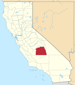
| State | California |
| County | Tulare |
| Elevation | 348 ft (106 m) |
| Time zone | UTC-8 (Pacific (PST)) |
| • Summer (DST) | UTC-7 (PDT) |
| Area code(s) | 559 |
| GNIS feature ID | 1660407[1] |
Cairns Corner is an unincorporated community in Tulare County, California, United States. The community is located near the junction of California State Route 65 and California State Route 137 2.5 miles (4.0 km) west of Lindsay.[2]
References
- ↑ U.S. Geological Survey Geographic Names Information System: Cairns Corner, California
- ↑ Durham, David L. (1998). California's Geographic Names: A Gazetteer of Historic and Modern Names of the State. Quill Driver Books. p. 1010. ISBN 1-884995-14-4.
This article is issued from
Wikipedia.
The text is licensed under Creative Commons - Attribution - Sharealike.
Additional terms may apply for the media files.