Yi-ngo District
| Yi-ngo ยี่งอ | |
|---|---|
| Amphoe | |
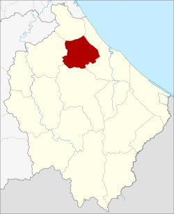 Amphoe location in Narathiwat Province | |
| Coordinates: 6°24′11″N 101°42′22″E / 6.40306°N 101.70611°ECoordinates: 6°24′11″N 101°42′22″E / 6.40306°N 101.70611°E | |
| Country | Thailand |
| Province | Narathiwat |
| Seat | Yi-ngo |
| Area | |
| • Total | 200.516 km2 (77.420 sq mi) |
| Population (2014) | |
| • Total | 44,817 |
| • Density | 202.9/km2 (526/sq mi) |
| Time zone | UTC+7 (ICT) |
| Postal code | 96180 |
| Geocode | 9604 |
Yi-ngo (Thai: ยี่งอ, pronounced [jîː.ŋɔ̄ː]) is a district (amphoe) of Narathiwat Province, southern Thailand.
Geography
Neighboring districts are (from the north clockwise) Bacho, Mueang Narathiwat, Ra-ngae, and Rueso.
History
Yi-ngo was originally a district in Sai Buri Province. In 1909 it was reassigned to Bang Nara Province, present-day Narathiwat Province.[1]
Administration
Central administration
Yi-ngo District is divided into six sub-districts (tambon), which are further subdivided into 40 administrative villages (Muban).
| No. | Name | Thai | Villages | Pop.[2] |
|---|---|---|---|---|
| 1. | Yi-ngo | ยี่งอ | 7 | 9,760 |
| 2. | Lahan | ละหาร | 8 | 8,088 |
| 3. | Cho Bo | จอเบาะ | 9 | 8,402 |
| 4. | Lubo Baya | ลุโบะบายะ | 5 | 4,537 |
| 5. | Lubo Buesa | ลุโบะบือซา | 6 | 4,951 |
| 6. | Tapoyo | ตะปอเยาะ | 5 | 9,079 |
Local administration
There is one sub-district municipality (thesaban tambon) in the district:
- Yi-ngo (Thai: เทศบาลตำบลยี่งอ) consisting of parts of sub-district Yi-ngo.
There are 6 subdistrict administrative organizations (SAO) in the district:
- Yi-ngo (Thai: องค์การบริหารส่วนตำบลยี่งอ) consisting of parts of sub-district Yi-ngo.
- Lahan (Thai: องค์การบริหารส่วนตำบลละหาร) consisting of sub-district Lahan.
- Cho Bo (Thai: องค์การบริหารส่วนตำบลจอเบาะ) consisting of sub-district Cho Bo.
- Lubo Baya (Thai: องค์การบริหารส่วนตำบลลุโบะบายะ) consisting of sub-district Lubo Baya.
- Lubo Buesa (Thai: องค์การบริหารส่วนตำบลลุโบะบือซา) consisting of sub-district Lubo Buesa.
- Tapoyo (Thai: องค์การบริหารส่วนตำบลตะปอเยาะ) consisting of sub-district Tapoyo.
References
- ↑ แจ้งความกระทรวงมหาดไทย เรื่อง โอนอำเภอยี่งอ ซึ่งขึ้นเมืองสายบุรี ไปขึ้นจังหวัดบางนราในมณฑลปัตตานี ยกกิ่งอำเภอจำปากอ ตั้งเป็นอำเภอจำปากอขึ้นเมืองสายบุรี (PDF). Royal Gazette (in Thai). 26 (0 ง): 1950. 1909-12-05.
- ↑ "Population statistics 2014" (in Thai). Department of Provincial Administration. Retrieved 2015-06-18.
External links
- amphoe.com (Thai)
This article is issued from
Wikipedia.
The text is licensed under Creative Commons - Attribution - Sharealike.
Additional terms may apply for the media files.