Yeraskhahun
Coordinates: 40°04′20″N 44°12′57″E / 40.07222°N 44.21583°E
| Yeraskhahun Երասխահուն | |
|---|---|
 Yeraskhahun Երասխահուն | |
| Coordinates: 40°04′20″N 44°12′57″E / 40.07222°N 44.21583°E | |
| Country | Armenia |
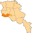
| Marz (Province) | Armavir |
| Founded | 1920 |
| Population (2011) | |
| • Total | 1,834 |
| Time zone | UTC+4 ( ) |
Yeraskhahun (Armenian: Երասխահուն, until 1950, Kuru-Araz) is a village in the Armavir Province of Armenia. Half of the population (around 930) of the village are Yazidis.
See also
References
- Yeraskhahun at GEOnet Names Server
- World Gazeteer: Armenia – World-Gazetteer.com
- Report of the results of the 2001 Armenian Census, National Statistical Service of the Republic of Armenia
- Kiesling, Brady (2005), Rediscovering Armenia: Guide, Yerevan, Armenia: Matit Graphic Design Studio
- Brady Kiesling, Rediscovering Armenia, p. 40; original archived at Archive.org, and current version online on Armeniapedia.org.
This article is issued from
Wikipedia.
The text is licensed under Creative Commons - Attribution - Sharealike.
Additional terms may apply for the media files.