Taronik
Coordinates: 40°07′59″N 44°11′57″E / 40.13306°N 44.19917°E
| Taronik Տարոնիկ | |
|---|---|
 Standing stones at the ruins of the Metsamor site near Taronik | |
 Taronik | |
| Coordinates: 40°07′59″N 44°11′57″E / 40.13306°N 44.19917°E | |
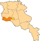
| Country | Armenia |
| Marz (Province) | Armavir |
| Population (2008) | |
| • Total | 2,036 |
| Time zone | UTC+4 ( ) |
Taronik (Armenian: Տարոնիկ), formerly known as Zeyva Turkakan (Turkish Zeyva) and Verin Zeyva, is a village in the Armavir Province of Armenia. The Iron Age settlement of Metsamor site is located only 1 km southwest of Taronik.
History
The archaeological site of Metsamor Castle has been populated from the 5th millennium BC until the 18th century AD. The excavations of the tombs of Metsamor castle began in 1965. It is notable with its observatory and temple complexes consisted of seven sanctuaries. The neolithic stone circles of c. 5000 BC, are located adjacent to the castle site. The site also hosts the Metsamor Museum, marking the bronze-age settlement. Excavations at the site demonstrate that there had been a vibrant cultural centre in Metsamor from roughly 4000 to 3000 BC, and many artifacts are housed in the museum. The settlement persisted through the Middle Ages.
See also
References
- Taronik at GEOnet Names Server
- World Gazeteer: Armenia – World-Gazetteer.com
- Report of the results of the 2001 Armenian Census, National Statistical Service of the Republic of Armenia
- Kiesling, Brady (2005), Rediscovering Armenia: Guide, Yerevan, Armenia: Matit Graphic Design Studio
- Brady Kiesling, Rediscovering Armenia, p. 37; original archived at Archive.org, and current version online on Armeniapedia.org.