Wutach (village)
| Wutach | ||
|---|---|---|
| ||
 Wutach Location of Wutach within Waldshut district 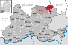  | ||
| Coordinates: 47°50′17″N 08°26′40″E / 47.83806°N 8.44444°ECoordinates: 47°50′17″N 08°26′40″E / 47.83806°N 8.44444°E | ||
| Country | Germany | |
| State | Baden-Württemberg | |
| Admin. region | Freiburg | |
| District | Waldshut | |
| Government | ||
| • Mayor | Christian Mauch (CDU) | |
| Area | ||
| • Total | 30.48 km2 (11.77 sq mi) | |
| Elevation | 730 m (2,400 ft) | |
| Population (2017-12-31)[1] | ||
| • Total | 1,216 | |
| • Density | 40/km2 (100/sq mi) | |
| Time zone | CET/CEST (UTC+1/+2) | |
| Postal codes | 79879 | |
| Dialling codes | 07709 | |
| Vehicle registration | WT | |
| Website | www.wutach.de | |

Wutach is a rural municipality on the northern edge of the district of Waldshut in Baden-Württemberg in Germany. It has a combined administration with the neighbouring town of Bonndorf. There is no town as such called Wutach: the municipality includes the villages of Ewattingen (c. 800 inhabitants), Münchingen (c. 300) and Lembach (c. 200). Most of the municipality's facilities (e.g. council offices, and primary school) are in Ewattingen.
Wutach lies to the south of the Wutach Gorge, through which the River Wutach flows.
References
- ↑ "Bevölkerung nach Nationalität und Geschlecht am 31. Dezember 2017". Statistisches Landesamt Baden-Württemberg (in German). 2018.
This article is issued from
Wikipedia.
The text is licensed under Creative Commons - Attribution - Sharealike.
Additional terms may apply for the media files.