Wurm
| Wurm | |
|---|---|
 Zwei Mühlen on the Wurm between Schloss Rimburg (D) and the village of Rimburg (NL) | |
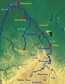 Course of the Inde, Wurm and Rur | |
| Country | Germany |
| State | North Rhine-Westphalia |
| Reference no. | DE: 2828 |
| Physical characteristics | |
| Main source |
South of Aachen 265 m above sea level (NN) 50°44′15″N 6°05′16″E / 50.7374694°N 6.0877111°ECoordinates: 50°44′15″N 6°05′16″E / 50.7374694°N 6.0877111°E |
| River mouth |
North of Heinsberg into the Rur 32 m above sea level (NN) 51°05′52″N 6°06′22″E / 51.0977°N 6.1062°E |
| Length | 57.1 km (35.5 mi) [1] |
| Basin features | |
| Progression | Rur→ Meuse→ North Sea |
| Basin size | 355.518 km2 (137.266 sq mi) [1] |
| Landmarks |
|
The Wurm (German; Dutch: Worm) is a river in the state of North Rhine-Westphalia in western Germany. It rises in the Eifel mountains and flows for 57 kilometres before discharging into the Rur.
Geography
The Wurm is a left (western) arm of the Rur (Dutch: Roer). The Rur becomes an offshoot of the Maas.
The wellspring of the Wurm are a few brooks in the woodlands southwest of Aachen, which make up the Wurm after the Diepenbenden waterstock. From there the Wurm nowadays flows through canals through the city of Aachen, until it upsprings again at the Europaplatz in the east of Aachen. North of Aachen (between Kerkrade and Herzogenrath) the river landmarks the border with the Netherlands for roughly. 10 km. It flows into the Rur near Heinsberg.
Other towns alongst the river Wurm are Würselen, Übach-Palenberg and Geilenkirchen.
The name Wurm is thought to originate from the German word warm (same meaning in English), as the headwater brooks were fed from the hotsprings in Aachen.
Gallery
 Meanders of the Wurm near Kohlscheid
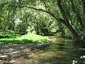 Wilderness
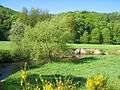
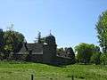 Rimburg Castle near Übach-Palenberg
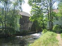
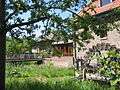 Watermill near Zweibrüggen
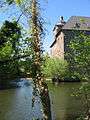 Castle Trips, Geilenkirchen
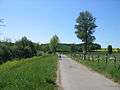 Wurm valley near Süggerath
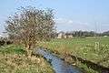 Wurm at Gut Kalkofen, Aachen
See also
- Rur Basin
- List of rivers of North Rhine-Westphalia

References
- Kalinka, G.; Schütten, J. (1993). Naturraum Wurmtal. Wurmverlag Herzogenrath. ASIN B0029ZWV8I.
| Authority control |
|---|