Wrights Creek, Queensland
| Wrights Creek Queensland | |||||||||||||||
|---|---|---|---|---|---|---|---|---|---|---|---|---|---|---|---|
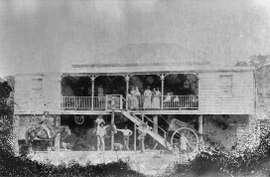 Collinson's house, Bruce Highway, Wrights Creek | |||||||||||||||
 Wrights Creek | |||||||||||||||
| Coordinates | 17°01′16″S 145°46′26″E / 17.0211°S 145.7738°ECoordinates: 17°01′16″S 145°46′26″E / 17.0211°S 145.7738°E | ||||||||||||||
| Population | 156 (2016 census)[1] | ||||||||||||||
| • Density | 6.53/km2 (16.91/sq mi) | ||||||||||||||
| Postcode(s) | 4869 | ||||||||||||||
| Area | 23.9 km2 (9.2 sq mi) | ||||||||||||||
| LGA(s) | Cairns Region | ||||||||||||||
| State electorate(s) | Mulgrave | ||||||||||||||
| Federal Division(s) | |||||||||||||||
| |||||||||||||||
Wrights Creek is a locality in the Cairns Region, Queensland, Australia.[2] In the 2016 census, Wrights Creek had a population of 156 people.[1]
Geography
The locality is mostly low-lying flat land (approx 10 metres above sea level) with a small area of mountainous area in the south-west of the locality rising to an unnamed peak of 200 metres above sea level. The Trinity Inlet (aka Smith Creek) is the northern boundary of the locality while Wrights Creek (the watercourse from which the locality takes its name) and Mackey Creek form parts of the eastern and western boundaries of the locality. Warners Road is the southern boundary. The northert part of the locality is undeveloped wetlands and the mountainous region is also undeveloped. However, most of the locality is used for farming (predominantly sugarcane).[3]
The Bruce Highway and North Coast railway line pass through the south-western part of the locality; Kamma railway station services the local area. There is also a network of cane tramways to transport the harvested sugarcane to the Mulgrave Sugar Mill.[3][4]
History
Wright's Creek Provisional School opened on 8 October 1894, becoming Wright's Creek State School on 1 January 1909. It closed in 1953.[5]
References
- 1 2 Australian Bureau of Statistics (27 June 2017). "Wrights Creek". 2016 Census QuickStats. Retrieved 22 April 2018.

- ↑ "Wrights Creek - locality in Cairns Region (entry 48946)". Queensland Place Names. Queensland Government. Retrieved 12 December 2017.
- 1 2 "Queensland Globe". State of Queensland. Retrieved 13 December 2017.
- ↑ "Kamma - railway station in Cairns Region (entry 17631)". Queensland Place Names. Queensland Government. Retrieved 13 December 2017.
- ↑ Queensland Family History Society (2010), Queensland schools past and present (Version 1.01 ed.), Queensland Family History Society, ISBN 978-1-921171-26-0
External links
![]()