Wooster, Arkansas
| Wooster, Arkansas | |
|---|---|
| City | |
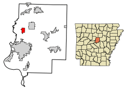 Location of Wooster in Faulkner County, Arkansas. | |
| Coordinates: 35°12′2″N 92°27′13″W / 35.20056°N 92.45361°WCoordinates: 35°12′2″N 92°27′13″W / 35.20056°N 92.45361°W | |
| Country | United States |
| State | Arkansas |
| County | Faulkner |
| Area[1] | |
| • Total | 2.87 sq mi (7.43 km2) |
| • Land | 2.87 sq mi (7.43 km2) |
| • Water | 0.00 sq mi (0.00 km2) |
| Elevation | 318 ft (97 m) |
| Population (2010) | |
| • Total | 860 |
| • Estimate (2017)[2] | 1,061 |
| • Density | 369.56/sq mi (142.71/km2) |
| Time zone | UTC-6 (Central (CST)) |
| • Summer (DST) | UTC-5 (CDT) |
| ZIP code | 72181 |
| Area code(s) | 501 |
| FIPS code | 05-76820 |
| GNIS feature ID | 0078810 |
| Website |
woosterar |
Wooster is a city[3] in Faulkner County, Arkansas, United States. The population was 860 at the 2010 census,[4] up from 516 at the 2000 census. It is part of the Little Rock–North Little Rock–Conway Metropolitan Statistical Area.
Geography
Wooster is located in northwestern Faulkner County at 35°12′2″N 92°27′13″W / 35.20056°N 92.45361°W (35.200630, -92.453694).[5] Arkansas Highway 25 passes through the city, leading northeast 5 miles (8 km) to Greenbrier and south 9 miles (14 km) to Conway, the county seat.
According to the United States Census Bureau, the town has a total area of 2.9 square miles (7.4 km2), all land.[4]
Demographics
| Historical population | |||
|---|---|---|---|
| Census | Pop. | %± | |
| 1960 | 161 | — | |
| 1970 | 307 | 90.7% | |
| 1980 | 398 | 29.6% | |
| 1990 | 414 | 4.0% | |
| 2000 | 516 | 24.6% | |
| 2010 | 860 | 66.7% | |
| Est. 2017 | 1,061 | [2] | 23.4% |
| U.S. Decennial Census[6] | |||
As of the census[7] of 2000, there were 516 people, 200 households, and 154 families residing in the town. The population density was 77.5/km² (200.8/mi²). There were 214 housing units at an average density of 32.2/km² (83.3/mi²). The racial makeup of the town was 97.29% White, 0.19% Black or African American, 0.78% Native American, 0.58% Asian, 0.58% from other races, and 0.58% from two or more races. 0.97% of the population were Hispanic or Latino of any race.
There were 200 households out of which 33.5% had children under the age of 18 living with them, 64.0% were married couples living together, 10.0% had a female householder with no husband present, and 23.0% were non-families. 21.5% of all households were made up of individuals and 11.0% had someone living alone who was 65 years of age or older. The average household size was 2.58 and the average family size was 3.01.
In the town the population was spread out with 23.4% under the age of 18, 7.8% from 18 to 24, 28.9% from 25 to 44, 26.9% from 45 to 64, and 13.0% who were 65 years of age or older. The median age was 39 years. For every 100 females, there were 99.2 males. For every 100 females age 18 and over, there were 98.5 males.
The median income for a household in the town was $35,063, and the median income for a family was $39,375. Males had a median income of $30,438 versus $24,063 for females. The per capita income for the town was $15,421. About 4.5% of families and 9.0% of the population were below the poverty line, including 15.4% of those under age 18 and 9.7% of those age 65 or over.
References
- ↑ "2017 U.S. Gazetteer Files". United States Census Bureau. Retrieved Aug 22, 2018.
- 1 2 "Population and Housing Unit Estimates". Retrieved March 24, 2018.
- ↑ Local.Arkansas.gov - Wooster, retrieved September 3, 2012
- 1 2 "Geographic Identifiers: 2010 Census Summary File 1 (G001): Wooster town, Arkansas". American Factfinder. U.S. Census Bureau. Retrieved April 18, 2016.
- ↑ "US Gazetteer files: 2010, 2000, and 1990". United States Census Bureau. 2011-02-12. Retrieved 2011-04-23.
- ↑ "Census of Population and Housing". Census.gov. Archived from the original on May 11, 2015. Retrieved June 4, 2015.
- ↑ "American FactFinder". United States Census Bureau. Retrieved 2008-01-31.
Municipalities and communities of Faulkner County, Arkansas, United States | ||
|---|---|---|
| Cities | 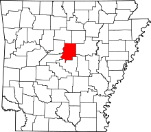 | |
| Towns | ||
| Unincorporated communities | ||
| Footnotes | ‡This populated place also has portions in an adjacent county or counties | |