Wood River, Nebraska
| Wood River, Nebraska | |
|---|---|
| City | |
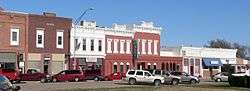 Ninth Street, Wood River | |
 Location of Wood River, Nebraska | |
| Coordinates: 40°49′18″N 98°36′3″W / 40.82167°N 98.60083°WCoordinates: 40°49′18″N 98°36′3″W / 40.82167°N 98.60083°W | |
| Country | United States |
| State | Nebraska |
| County | Hall |
| Area[1] | |
| • Total | 0.79 sq mi (2.05 km2) |
| • Land | 0.79 sq mi (2.05 km2) |
| • Water | 0 sq mi (0 km2) |
| Elevation | 1,965 ft (599 m) |
| Population (2010)[2] | |
| • Total | 1,325 |
| • Estimate (2016)[3] | 1,354 |
| • Density | 1,700/sq mi (650/km2) |
| Time zone | UTC-6 (Central (CST)) |
| • Summer (DST) | UTC-5 (CDT) |
| ZIP code | 68883 |
| Area code(s) | 308 |
| FIPS code | 31-53660 |
| GNIS feature ID | 0834860[4] |
| Website | http://woodriverne.com/ |
Wood River is a city in Hall County, Nebraska, United States. The population was 1,325 at the 2010 census. It is part of the Grand Island, Nebraska Micropolitan Statistical Area.
History
Wood River was first laid out in 1868, but when the railroad moved the depot, the town followed it, and moved to its current site in 1874.[5]
Geography
Wood River is located at 40°49′18″N 98°36′3″W / 40.82167°N 98.60083°W (40.821792, -98.600963).[6]
According to the United States Census Bureau, the city has a total area of 0.79 square miles (2.05 km2), all of it land.[1]
Demographics
| Historical population | |||
|---|---|---|---|
| Census | Pop. | %± | |
| 1890 | 481 | — | |
| 1900 | 589 | 22.5% | |
| 1910 | 796 | 35.1% | |
| 1920 | 820 | 3.0% | |
| 1930 | 751 | −8.4% | |
| 1940 | 829 | 10.4% | |
| 1950 | 858 | 3.5% | |
| 1960 | 828 | −3.5% | |
| 1970 | 1,147 | 38.5% | |
| 1980 | 1,334 | 16.3% | |
| 1990 | 1,156 | −13.3% | |
| 2000 | 1,204 | 4.2% | |
| 2010 | 1,325 | 10.0% | |
| Est. 2016 | 1,354 | [3] | 2.2% |
| U.S. Decennial Census[7] 2013 Estimate[8] | |||
2010 census
As of the census[2] of 2010, there were 1,325 people, 478 households, and 345 families residing in the city. The population density was 1,677.2 inhabitants per square mile (647.6/km2). There were 495 housing units at an average density of 626.6 per square mile (241.9/km2). The racial makeup of the city was 89.3% White, 0.1% Native American, 0.2% Asian, 9.6% from other races, and 0.9% from two or more races. Hispanic or Latino of any race were 17.7% of the population.
There were 478 households of which 38.3% had children under the age of 18 living with them, 55.6% were married couples living together, 10.3% had a female householder with no husband present, 6.3% had a male householder with no wife present, and 27.8% were non-families. 24.7% of all households were made up of individuals and 12% had someone living alone who was 65 years of age or older. The average household size was 2.65 and the average family size was 3.14.
The median age in the city was 37.5 years. 27.6% of residents were under the age of 18; 7.3% were between the ages of 18 and 24; 25.1% were from 25 to 44; 21.2% were from 45 to 64; and 18.6% were 65 years of age or older. The gender makeup of the city was 50.1% male and 49.9% female.
2000 census
As of the census of 2000, there were 1,204 people, 456 households, and 320 families residing in the city. The population density was 1,675.9 people per square mile (645.6/km²). There were 481 housing units at an average density of 669.5 per square mile (257.9/km²). The racial makeup of the city was 96.35% White, 0.25% African American, 0.08% Native American, 0.08% Asian, 2.82% from other races, and 0.42% from two or more races. Hispanic or Latino of any race were 12.46% of the population.
There were 456 households out of which 34.4% had children under the age of 18 living with them, 59.6% were married couples living together, 6.1% had a female householder with no husband present, and 29.8% were non-families. 27.0% of all households were made up of individuals and 15.1% had someone living alone who was 65 years of age or older. The average household size was 2.51 and the average family size was 3.03.
In the city, the population was spread out with 27.2% under the age of 18, 6.1% from 18 to 24, 27.4% from 25 to 44, 19.6% from 45 to 64, and 19.8% who were 65 years of age or older. The median age was 38 years. For every 100 females, there were 99.3 males. For every 100 females age 18 and over, there were 89.4 males.
As of 2000 the median income for a household in the city was $36,776, and the median income for a family was $44,453. Males had a median income of $27,596 versus $20,179 for females. The per capita income for the city was $16,275. About 10.1% of families and 12.8% of the population were below the poverty line, including 16.1% of those under age 18 and 9.7% of those age 65 or over.
Education
Wood River Rural Schools serves the community.
Notable people
- Scott Frost - professional American football player and college football coach
References
- 1 2 "US Gazetteer files 2010". United States Census Bureau. Retrieved 2012-06-24.
- 1 2 "American FactFinder". United States Census Bureau. Retrieved 2012-06-24.
- 1 2 "Population and Housing Unit Estimates". Retrieved June 9, 2017.
- ↑ "US Board on Geographic Names". United States Geological Survey. 2007-10-25. Retrieved 2008-01-31.
- ↑ August F. Buechler; Robert J. Barr; Dale P. Stough (1920). History of Hall County, Nebraska: A Narrative of the Past with Special Emphasis Upon the Pioneer Period of the County's History, and Chronological Presentation of Its Social, Commercial, Educational, Religious, and Civic Development from the Early Days to the Present Time, and Special Analysis of Its Military and Civil Participation in the Late World War. Western Publishing and Engraving Company. p. 120.
- ↑ "US Gazetteer files: 2010, 2000, and 1990". United States Census Bureau. 2011-02-12. Retrieved 2011-04-23.
- ↑ United States Census Bureau. "Census of Population and Housing". Retrieved July 17, 2014.
- ↑ "Population Estimates". United States Census Bureau. Retrieved 2014-07-17.
Municipalities and communities of Hall County, Nebraska, United States | ||
|---|---|---|
| Cities | ||
| Villages | ||
| Townships |
| |
| Unincorporated communities | ||
| Footnotes | ‡This populated place also has portions in an adjacent county or counties | |