Wisconsin Highway 48
| ||||
|---|---|---|---|---|
| Route information | ||||
| Maintained by WisDOT | ||||
| Length | 98.19 mi[1] (158.02 km) | |||
| Major junctions | ||||
| West end |
| |||
|
| ||||
| East end |
| |||
| Location | ||||
| Counties | Burnett, Polk, Barron, Washburn, Sawyer | |||
| Highway system | ||||
| ||||

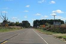
East terminus at WIS40
State Trunk Highway 48 (often called Highway 48, STH 48 or WIS 48) is a state highway in the U.S. state of Wisconsin. It runs east–west in northwest Wisconsin from Grantsburg to Exeland.
References
| Wikimedia Commons has media related to Wisconsin Highway 48. |
- ↑ Bessert, Chris. "Wisconsin Highways: Highways 40-49 (Highway 48)". Wisconsin Highways. Retrieved 2007-03-20.
This article is issued from
Wikipedia.
The text is licensed under Creative Commons - Attribution - Sharealike.
Additional terms may apply for the media files.