Wisconsin Highway 15
| ||||
|---|---|---|---|---|
|
WIS-15 highlighted in red | ||||
| Route information | ||||
| Maintained by WisDOT | ||||
| Length | 14.8 mi[1] (23.8 km) | |||
| Major junctions | ||||
| West end |
| |||
|
| ||||
| East end |
| |||
| Location | ||||
| Counties | Outagamie | |||
| Highway system | ||||
| ||||

State Trunk Highway 15 (STH 15, commonly known as Highway 15 or WIS 15) is a state highway running east–west across east-central Wisconsin. The route exists entirely within Outagamie County. Highway 15 provides a "shortcut" to Appleton from U.S. Highway 45 for travelers inbound from points north and west. Most of it was once part of US 45, which was redirected south of New London to bypass Appleton and provide direct access to Oshkosh and points south.
Route description
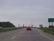
WIS 15 begins at the junction of US 45 and CTH T southeast of New London as a two-lane road and heads southeast to Hortonville. The route then continues southeast into Greenville where it becomes a multilane expressway just northwest of the village. The highway intersects WIS 76 in Greenville then continues southeast for one mile (1.6 km) before turning east at the junction with CTH CB. WIS 15 then junctions with US 41 where it ends and Northland Ave and CTH OO begins in the town of Grand Chute, just northwest of Appleton. The route between US 45 and Industrial Park Avenue west of Hortonville and from Greendale Rd east of Hortonville to Julius Drive west of Greenville now has centerline rumble strips.[2] WIS 15 provides access to Neuroscience Group Field at Fox Cities Stadium.[3]
History
This is the third iteration of the route number. The first iteration followed present day US 41 from the Illinois border to Marinette via Milwaukee, Fond du Lac, Appleton and Green Bay. The second is the more well-known alignment following the present day Interstate 43 from the Hale Interchange in Milwaukee to Interstate 90 in Beloit as the Rock Freeway. From the Hale Interchange, This iteration followed Interstate 894 northward then turned east onto National Avenue and ending in downtown Milwaukee.[1]
Previously, the current Highway 15 route was US 45 - which turned south at its intersection with WIS 76. WIS 76 continued straight on to intersect with Wisconsin Avenue (then U.S. Highway 10) at the north entrance road to the Fox River Mall in Appleton. The road was realigned as part of a large project that realigned US 10 and US 45. Essentially, the road south of Greenville became an extension of WIS 76 and Highway 15 is now the sole route number on the current stretch.[1]
Major intersections
The entire route is in Outagamie County.
| Location | mi | km | Destinations | Notes | |
|---|---|---|---|---|---|
| New London | |||||
| Hortonville | |||||
| Greenville | |||||
| Grand Chute | WIS 15 becomes CTH OO (Northland Ave) | ||||
| 1.000 mi = 1.609 km; 1.000 km = 0.621 mi | |||||
Future
The highway is currently being studied for expansion by WisDOT. This includes possible bypass options of Hortonville and capacity expansion. The limits of the study are from US 45 in New London to WIS 76 in Greenville (where the current multilane expressway begins)[4]
References
- 1 2 3 Bessert, Chris. "Wisconsin Highways: Highways 10-99 (Highway 15)". Wisconsin Highways. Retrieved 2007-03-20.
- ↑ Outagamie Co (pdf) (Map). Wisconsin Department of Transportation. Retrieved 2007-12-29.
- ↑ Google (2007-12-29). "Time Warner Cable Field at Fox Cities Stadium, Appleton" (Map). Google Maps. Google. Retrieved 2007-12-29.
- ↑ "Wis 15 Expansion Study". Wisconsin Department of Transportation.
| Wikimedia Commons has media related to Wisconsin Highway 15. |