Elm River Township, Michigan
| Elm River Township, Michigan | |
|---|---|
| Township | |
 Elm River Township, Michigan Location within the state of Michigan | |
| Coordinates: 46°53′27″N 88°51′19″W / 46.89083°N 88.85528°WCoordinates: 46°53′27″N 88°51′19″W / 46.89083°N 88.85528°W | |
| Country | United States |
| State | Michigan |
| County | Houghton |
| Area | |
| • Total | 93.3 sq mi (241.6 km2) |
| • Land | 91.3 sq mi (236.6 km2) |
| • Water | 1.9 sq mi (5.0 km2) |
| Elevation | 1,188 ft (362 m) |
| Population (2000) | |
| • Total | 169 |
| • Density | 1.9/sq mi (0.7/km2) |
| Time zone | UTC-5 (Eastern (EST)) |
| • Summer (DST) | UTC-4 (EDT) |
| FIPS code | 26-25660[1] |
| GNIS feature ID | 1626234[2] |
| Website | http://www.elmrivertownship.com/ |
Elm River Township is a civil township of Houghton County in the U.S. state of Michigan. The population was 169 at the 2000 census.
Geography
According to the United States Census Bureau, the township has a total area of 93.3 square miles (242 km2), of which 91.3 square miles (236 km2) is land and 1.9 square miles (4.9 km2) (2.06%) is water.
Communities
- Donken is an unincorporated community in the township.
- Elm River was an area around the operations of the Elm River Copper Company. It had a post office from 1900 until 1907.[3]
- Lake Roland is an unincorporated community in the township at 46°53′04″N 88°51′50″W / 46.88444°N 88.86389°W.[4]
- Twin Lakes is an unincorporated community in the township at 46°53′50″N 88°51′03″W / 46.89722°N 88.85083°W.[5]
- Winona is an unincorporated community in the township at 46°52′28″N 88°54′26″W / 46.87444°N 88.90722°W.[6] A copper mine was first opened in 1864 by the Winona Copper Mining Company identified by a line of Indian pits. The mine could not be profitably operated at the time and little was done with it until the Winona Copper Company was organized in 1898 and assumed ownership of the earlier mine.[7] A post office operated from April 5, 1899 until September 12, 1975, after which it was a Community Post Office of Toivola until January 1, 1982.[8]
- Wyandotte is an unincorporated community in the township at 46°53′24″N 88°52′31″W / 46.89000°N 88.87528°W.[9]
Demographics
As of the census[1] of 2000, there were 169 people, 70 households, and 56 families residing in the township. The population density was 1.9 per square mile (0.7/km²). There were 319 housing units at an average density of 3.5 per square mile (1.3/km²). The racial makeup of the township was 96.45% White, 0.59% Native American, 1.18% Pacific Islander, and 1.78% from two or more races. 41.4% were of Finnish, 21.4% Irish, 6.9% German, 6.2% English and 5.5% French ancestry according to Census 2000.
There were 70 households out of which 22.9% had children under the age of 18 living with them, 65.7% were married couples living together, 5.7% had a female householder with no husband present, and 18.6% were non-families. 17.1% of all households were made up of individuals and 8.6% had someone living alone who was 65 years of age or older. The average household size was 2.41 and the average family size was 2.63.
In the township the population was spread out with 17.8% under the age of 18, 5.3% from 18 to 24, 21.3% from 25 to 44, 34.9% from 45 to 64, and 20.7% who were 65 years of age or older. The median age was 48 years. For every 100 females, there were 103.6 males. For every 100 females age 18 and over, there were 104.4 males.
The median income for a household in the township was $27,813, and the median income for a family was $30,313. Males had a median income of $33,750 versus $20,000 for females. The per capita income for the township was $15,024. About 18.2% of families and 15.0% of the population were below the poverty line, including 14.8% of those under the age of eighteen and 18.8% of those sixty five or over.
References
Notes
- 1 2 "American FactFinder". United States Census Bureau. Archived from the original on 2013-09-11. Retrieved 2008-01-31.
- ↑ "Elm River Township, Michigan". Geographic Names Information System. United States Geological Survey.
- ↑ Romig 1986, p. 181.
- ↑ "Lake Roland, Michigan". Geographic Names Information System. United States Geological Survey.
- ↑ "Twin Lakes, Michigan". Geographic Names Information System. United States Geological Survey.
- ↑ "Winona, Michigan". Geographic Names Information System. United States Geological Survey.
- ↑ Stevens, Horace J. (1900). The Copper Handbook. Houghton, Michigan: Horace J. Stevens. pp. 275–279. OCLC 2342752. Retrieved 17 April 2011.
- ↑ "Winona Post Office (historical)". Geographic Names Information System. United States Geological Survey.
- ↑ "Wyandotte, Michigan". Geographic Names Information System. United States Geological Survey.
Sources
- Romig, Walter (October 1, 1986) [1973]. Michigan Place Names: The History of the Founding and the Naming of More Than Five Thousand Past and Present Michigan Communities. Great Lakes Books Series (Paperback). Detroit, Michigan: Wayne State University Press. ISBN 978-0-8143-1838-6.
External links
Municipalities and communities of Houghton County, Michigan, United States | ||
|---|---|---|
| Cities | 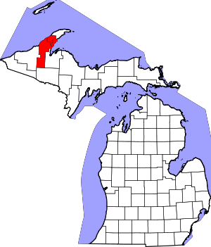 | |
| Villages | ||
| Charter townships | ||
| General law townships | ||
| CDPs | ||
| Other unincorporated communities | ||