Windham Airport
| Windham Airport | |||||||||||||||
|---|---|---|---|---|---|---|---|---|---|---|---|---|---|---|---|
| Summary | |||||||||||||||
| Airport type | Public | ||||||||||||||
| Owner | Connecticut Airport Authority | ||||||||||||||
| Location | Windham, Connecticut | ||||||||||||||
| Elevation AMSL | 247 ft / 75 m | ||||||||||||||
| Coordinates | 41°44′39″N 072°10′49″W / 41.74417°N 72.18028°W | ||||||||||||||
| Website | IJD Website | ||||||||||||||
| Map | |||||||||||||||
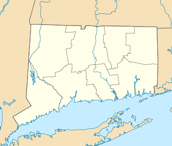 IJD Location of airport in Connecticut | |||||||||||||||
| Runways | |||||||||||||||
| |||||||||||||||
| Statistics (2005) | |||||||||||||||
| |||||||||||||||
Windham Airport (ICAO: KIJD, FAA LID: IJD) is a public airport located three miles (5 km) northeast of the central business district of Willimantic, a city in Windham County, Connecticut, United States. It is owned by the Connecticut Airport Authority.[1] It is included in the Federal Aviation Administration (FAA) National Plan of Integrated Airport Systems for 2017–2021, in which it is categorized as a local general aviation facility.[2]
Although most U.S. airports use the same three-letter location identifier for the FAA and IATA, Windham Airport is assigned IJD by the FAA but has no designation from the IATA.[3]
Facilities and aircraft
Windham Airport covers an area of 280 acres (110 ha) which contains two asphalt paved runways: 9/27 measuring 4,278 by 100 ft (1,304 by 30 m) and 18/36 measuring 2,797 by 75 ft (853 by 23 m).[1]
For the 12-month period ending October 1, 2005, the airport had 30,690 aircraft operations, an average of 84 per day: 98% general aviation, 2% air taxi and <1% military. There are 67 aircraft based at this airport: 93% single engine and 7% multi-engine.
Rentable aircraft include Cessna 152s and 172s, Piper Warriors, and a Piper Arrow.[1]
A aircraft school was located on the property, but has since closed down.[4]
Climate
| Month | Jan | Feb | Mar | Apr | May | Jun | Jul | Aug | Sep | Oct | Nov | Dec | Year |
|---|---|---|---|---|---|---|---|---|---|---|---|---|---|
| Record high °F (°C) | 69 (21) |
72 (22) |
82 (28) |
93 (34) |
95 (35) |
98 (37) |
100 (38) |
100 (38) |
100 (38) |
88 (31) |
80 (27) |
75 (24) |
100 (38) |
| Average high °F (°C) | 35.3 (1.8) |
38.4 (3.6) |
47.3 (8.5) |
59.3 (15.2) |
70.1 (21.2) |
78.0 (25.6) |
82.3 (27.9) |
80.8 (27.1) |
73.8 (23.2) |
62.1 (16.7) |
51.9 (11.1) |
40.3 (4.6) |
60 (15.5) |
| Daily mean °F (°C) | 29.0 (−1.7) |
31.7 (−0.2) |
38.3 (3.5) |
48.1 (8.9) |
57.9 (14.4) |
67.7 (19.8) |
73.4 (23) |
72.1 (22.3) |
64.9 (18.3) |
54.0 (12.2) |
44.7 (7.1) |
34.7 (1.5) |
51.4 (10.8) |
| Average low °F (°C) | 17.0 (−8.3) |
19.6 (−6.9) |
26.3 (−3.2) |
36.2 (2.3) |
45.9 (7.7) |
55.5 (13.1) |
61.0 (16.1) |
59.9 (15.5) |
51.4 (10.8) |
39.6 (4.2) |
31.4 (−0.3) |
22.3 (−5.4) |
38.8 (3.8) |
| Record low °F (°C) | −27 (−33) |
−21 (−29) |
−16 (−27) |
6 (−14) |
22 (−6) |
30 (−1) |
37 (3) |
32 (0) |
20 (−7) |
15 (−9) |
1 (−17) |
−18 (−28) |
−27 (−33) |
| Average precipitation inches (mm) | 3.36 (85.3) |
3.25 (82.6) |
4.32 (109.7) |
3.74 (95) |
3.49 (88.6) |
3.68 (93.5) |
3.43 (87.1) |
3.35 (85.1) |
3.44 (87.4) |
3.94 (100.1) |
3.99 (101.3) |
3.78 (96) |
43.77 (1,111.7) |
| Average snowfall inches (cm) | 8.1 (20.6) |
11.1 (28.2) |
5.5 (14) |
1.1 (2.8) |
0.0 (0) |
0.0 (0) |
0.0 (0) |
0.0 (0) |
0.0 (0) |
0.0 (0) |
0.9 (2.3) |
6.7 (17) |
33.4 (84.9) |
| Average precipitation days (≥ 0.1 in) | 6 | 6 | 7 | 7 | 8 | 7 | 6 | 5 | 6 | 6 | 6 | 7 | 72 |
| Average snowy days (≥ 0.1 in.) | 4 | 4 | 3 | 0 | 0 | 0 | 0 | 0 | 0 | 0 | 1 | 2 | 15 |
| Source: [5] [6] | |||||||||||||
References
- 1 2 3 4 FAA Airport Master Record for IJD (Form 5010 PDF), effective 2007-07-05
- ↑ "List of NPIAS Airports" (PDF). FAA.gov. Federal Aviation Administration. 21 October 2016. Retrieved 27 November 2016.
- ↑ Great Circle Mapper: KIJD - Willimantic, Connecticut (Windham Airport)
- ↑ webmaster@premierflightct.com. "Windham Airport KIJD". www.premierflightct.com. Retrieved 2016-11-19.
- ↑ "NOWData for Windham Airport". NOAA. Retrieved September 10, 2016.
- ↑ "Intellicast Willimantic, Connecticut Historical Averages". The Weather Company. Retrieved January 11, 2017.
External links
- Windham Airport
- FAA Terminal Procedures for IJD, effective October 11, 2018
- Resources for this airport:
- FAA airport information for IJD
- AirNav airport information for KIJD
- FlightAware airport information and live flight tracker
- NOAA/NWS latest weather observations
- SkyVector aeronautical chart, Terminal Procedures