Windermere, British Columbia
| Windermere | |
|---|---|
| Community | |
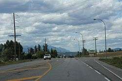 Looking northwest on BC 93 / BC 95 at Windermere | |
 Windermere Location of Windermere in British Columbia | |
| Coordinates: 50°27′49″N 115°59′20″W / 50.46361°N 115.98889°W | |
| Country |
|
| Province |
|
| Regional district | East Kootenay |
| Founded | 1924[1] |
| Dissolved | 1983[1] |
| Government | |
| • Type | Unincorporated |
| • Governing body | Regional District of East Kootenay Council |
| Population (2016) | |
| • Total | 1,092[2] |
| Time zone | UTC-7 (MST) |
| • Summer (DST) | UTC-6 (MDT) |
| Highways |
|
| Waterways | Windermere Lake, Columbia River |
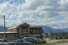
Windermere Fire Hall
Windermere is a community and designated place located south of Invermere on Windermere Lake in the Regional District of East Kootenay.
Demographics
References
- 1 2 "Place names - Windermere". Natural Resources Canada. Government of Canada. October 6, 2016. Retrieved October 19, 2017.
- ↑ "Census Profile, 2016 Census - Windermere, BC". Statistics Canada. Government of Canada. August 25, 2017. Retrieved October 19, 2017.
External links
| Subdivisions |  | |
|---|---|---|
| Communities | ||
| Metro areas and agglomerations | ||
| Villages |
| |
| ||
This article is issued from
Wikipedia.
The text is licensed under Creative Commons - Attribution - Sharealike.
Additional terms may apply for the media files.