Parson, British Columbia
| Parson | |
|---|---|
 Some buildings in Parson on BC Highway 95 | |
 Parson Location of Parson in British Columbia | |
| Coordinates: 51°04′12″N 116°38′05″W / 51.0701344°N 116.634861°WCoordinates: 51°04′12″N 116°38′05″W / 51.0701344°N 116.634861°W | |
| Country |
|
| Province |
|
| Region | Columbia Valley |
| Regional District | Columbia-Shuswap |
| Time zone | UTC-7 (MST) |
| • Summer (DST) | UTC-6 (MDT) |
| Postal code | V0A 1L0 |
| Area code(s) | 250, 778 |

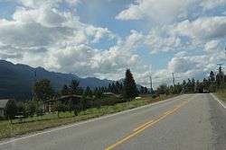
Entering Parson on British Columbia Highway 95
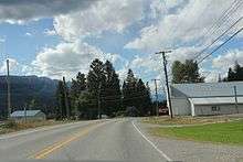
Looking northwest at some buildings in Parson on British Columbia Highway 95.
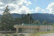
The Columbia Valley Elementary School at Parson
Parson is an unincorporated community in the Columbia-Shuswap Regional District region of British Columbia. It is located along the Upper Columbia River.[1] The community has the post code of V0A 1L0. British Columbia Highway 95 passes through the community.[2]
References
- ↑ "BC Geographical Names". BC Geographical Names database. Retrieved 5 March 2015.
- ↑ "Location of Parson, BC". Google Maps. Retrieved 5 March 2015.
This article is issued from
Wikipedia.
The text is licensed under Creative Commons - Attribution - Sharealike.
Additional terms may apply for the media files.