Williston, Vermont
| Williston, Vermont | |
|---|---|
| Town | |
| Motto(s): "Old town charm, new town spirit" | |
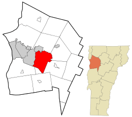 Location in Chittenden County and the state of Vermont. | |
 Williston, Vermont Location in the United States | |
| Coordinates: 44°26′43″N 73°5′57″W / 44.44528°N 73.09917°WCoordinates: 44°26′43″N 73°5′57″W / 44.44528°N 73.09917°W | |
| Country | United States |
| State | Vermont |
| County | Chittenden |
| Communities |
Williston North Williston Kirby Corner |
| Area | |
| • Total | 30.6 sq mi (79.2 km2) |
| • Land | 30.1 sq mi (77.9 km2) |
| • Water | 0.5 sq mi (1.3 km2) |
| Elevation | 604 ft (184 m) |
| Population (2010) | |
| • Total | 8,698 |
| • Density | 289/sq mi (111.7/km2) |
| Time zone | UTC-5 (Eastern (EST)) |
| • Summer (DST) | UTC-4 (EDT) |
| ZIP code | 05495 |
| Area code(s) | 802 |
| FIPS code | 50-84475[1] |
| GNIS feature ID | 1462263[2] |
| Website |
www |
Williston is a town in Chittenden County, Vermont, United States. Originally rural and laid out with many farms, in recent decades it has developed into a thriving suburb of Burlington, the largest city in the state of Vermont. The population of Williston was 8,698 at the 2010 census,[3] an increase of over 1,000 people since the 2000 census. The estimated population in 2015 estimate was 9,409.[4] Williston is one of the fastest-growing towns in Vermont, and while becoming more populated, it has also developed as a major retail center for the Burlington area as well as much of central and northern Vermont.[5] The town contains the village of Williston, which is unincorporated.
History
The town was named for Samuel Willis, a landholder and founded in 1763 as a royal grant from Governor Benning Wentworth of the Royal colony of New Hampshire. [6]
Events:
During the night of July 7, 1984, an Amtrak train with 287 people aboard hit a landslide and derailed, killing five people and injuring about two hundred. Although the accident triggered one of Vermont's most intensive emergency responses, the final victims were not rescued until the end of the day.[7]
A private, boarding high school, Pine Ridge, was founded in 1968 to serve learning-disabled students. It closed in June 2009.[8]
The town is notable for its fine and well preserved central collection of brick nineteenth century civic and religious buildings including the "old Brick Church" of 1832, considered one of Vermont's finest country Gothic churches; the former Universalist Church, now the Town Hall, of 1860; the former Methodist Church of 1848, now the Town Annex; former Town Hall of approximately 1840. Also is the regal Federated Church of 1867, formerly the Methodist Episcopal Church, designed by noted Boston architect John Stevens. On the western side of the town, bordering South Burlington, is Vermont's largest mercantile development with numerous "big box" stores and other commercial activities, making it a destination from all over the region.
The town was also the home of several generations of the Chittenden family, for whom the surrounding county, Vermont's most populous, is named. A number of beautiful original Chittenden family homes still stand in the town. Thomas Chittenden, the President of the Vermont Republic, and first governor of the state had his home in Williston and is buried in the central cemetery, with a prominent memorial.
Geography
Williston is in central Chittenden County, bordered on the north by the Winooski River. The city of South Burlington is to the west. According to the United States Census Bureau, Williston has a total area of 30.6 square miles (79.2 km2), of which 30.1 square miles (77.9 km2) is land and 0.50 square miles (1.3 km2), or 1.65%, is water.[3]
Brooks
Allen Brook drains the center of the town. It begins and flows from Mud Pond north to the village of Williston, and then in a northwesterly direction where it meets the Winooski River. It has a length of 10 miles (16 km) and drains a watershed covering 6,900 acres (2,800 ha).
Muddy Brook flows on the western edge of Williston and marks the border between Williston and South Burlington.
Demographics
| Historical population | |||
|---|---|---|---|
| Census | Pop. | %± | |
| 1790 | 471 | — | |
| 1800 | 836 | 77.5% | |
| 1810 | 1,185 | 41.7% | |
| 1820 | 1,246 | 5.1% | |
| 1830 | 1,608 | 29.1% | |
| 1840 | 1,554 | −3.4% | |
| 1850 | 1,669 | 7.4% | |
| 1860 | 1,479 | −11.4% | |
| 1870 | 1,441 | −2.6% | |
| 1880 | 1,342 | −6.9% | |
| 1890 | 1,161 | −13.5% | |
| 1900 | 1,176 | 1.3% | |
| 1910 | 1,000 | −15.0% | |
| 1920 | 929 | −7.1% | |
| 1930 | 961 | 3.4% | |
| 1940 | 1,021 | 6.2% | |
| 1950 | 1,182 | 15.8% | |
| 1960 | 1,484 | 25.5% | |
| 1970 | 3,187 | 114.8% | |
| 1980 | 3,843 | 20.6% | |
| 1990 | 4,887 | 27.2% | |
| 2000 | 7,650 | 56.5% | |
| 2010 | 8,698 | 13.7% | |
| Est. 2015 | 9,409 | [4] | 8.2% |
| U.S. Decennial Census[9] | |||
As of the census[1] of 2010, there were 8,698 people, 2,921 households, and 2,141 families residing in the town. The population density was 252.1 people per square mile (97.4/km2). There were 3,036 housing units at an average density of 100.1 per square mile (38.6/km2). The racial makeup of the town was 95.6% White, 1.0% African American, 0.2% Native American, 2.0% Asian, 0.01% Pacific Islander, 0.10% from other races, and 1.1% from two or more races. Hispanic or Latino of any race were 1.5% of the population.
There were 2,921 households, out of which 36.8% had children under the age of 18 living with them, 65.1% were married couples living together, 5.3% had a female householder with no husband present, and 26.7% were non-families. 20.4% of all households were made up of individuals, and 7.9% had someone living alone who was 65 years of age or older. The average household size was 2.59 and the average family size was 3.02.
In the town, the population was spread out, with 27.5% under the age of 18, 4.1% from 18 to 24, 32.0% from 25 to 44, 24.6% from 45 to 64, and 11.7% who were 65 years of age or older. The median age was 39 years. For every 100 females, there were 95.8 males. For every 100 females age 18 and over, there were 91.6 males.
The median income for a household in the town was $61,467, and the median income for a family was $69,762. Males had a median income of $49,048, versus $31,740 for females. The per capita income for the town was $29,757. About 0.8% of families and 1.5% of the population were below the poverty line, including 0.8% of those under age 18 and 4.9% of those age 65 or over.
Economy
One measure of economic activity is retail sales. Williston led the state in 2007 with US$434.8 million.[5] The part of town known as Taft Corners[10] has a number of big-box stores, including Walmart, Home Depot, Bed Bath and Beyond, Petsmart, Staples, Old Navy, and Best Buy.
Government and infrastructure
The Vermont Department of Corrections is headquartered in the White Cap Business Park in Williston.[11][12]
Education
The town has two schools: Allen Brook School, Pre-K-2, and Williston Central School, 3–8.
The Williston school district is part of the Chittenden South Supervisory Union. It therefore sends its students of high school age to Champlain Valley Union High School, which it supports through taxation.[13]
Transportation
Bus service is provided by Chittenden County Transportation Authority. This transportation brings residents and workers to South Burlington and Burlington, the central locations of the bus system.
Major routes
Interstate 89 passes through town from east to west, though it is signed north-south. There is an interchange just south of downtown.
U.S. Route 2, also known as Williston Road, passes through town from east to west. Williston's historic village is located along U.S. 2 in the center of town.
Vermont Route 2A provides a north-south route through town, connecting it to Hinesburg and Essex Junction. Much of the town's retail development, including nearly all of its big-box stores, is located along Route 2A, which runs through the western part of Williston and intersects I-89 and U.S. Route 2.
Notable people
- Edwin Atwater, Canadian businessperson and politician
- Thomas Chittenden, founder of Williston, Vermont, and first governor of the state of Vermont
- Ben Cohen, entrepreneur and co-founder of Ben & Jerry's[14]
- Jerry Greenfield, entrepreneur and co-founder of Ben & Jerry's
- Raul Hilberg, Austrian-born historian and leading scholar on the Holocaust
- Haviland Smith, retired CIA officer and former station chief
See also
References
- 1 2 "American FactFinder". United States Census Bureau. Retrieved 2008-01-31.
- ↑ "US Board on Geographic Names". United States Geological Survey. 2007-10-25. Retrieved 2008-01-31.
- 1 2 "Geographic Identifiers: 2010 Census Summary File 1 (G001): Williston town, Chittenden County, Vermont". U.S. Census Bureau, American Factfinder. Retrieved August 19, 2015.
- 1 2 "Annual Estimates of the Resident Population for Incorporated Places: April 1, 2010 to July 1, 2014". Retrieved June 4, 2015.
- 1 2 McLean, Dan (July 13, 2008). Retail Sales by the numbers. Burlington Free Press.
- ↑ "Profile for Williston, Vermont". ePodunk. Retrieved May 8, 2010.
- ↑ Sutkowski, Matt (July 7, 2009). "Fatal crash 25 years ago leaves mark". Burlington, Vermont: Burlington Free Press. pp. 1B.
- ↑ Walsh, Molly (March 20, 2009). "Pine Ridge School to close". The Burlington Free Press. Retrieved 5 July 2013.
- ↑ "U.S. Decennial Census". United States Census Bureau. Retrieved May 16, 2015.
- ↑ "Many flunk Taft Corners spelling test". Williston Observer. February 28, 2007.
- ↑ "Contact the Vermont Department of Corrections." Vermont Department of Corrections. Retrieved on December 6, 2015. Physical Address: 426 Industrial Ave. Williston, VT 05495"
- ↑ Annual Report 2014". Community High School of Vermont. Retrieved on December 6, 2015. Second page: "Physical Address: White Cap Business Park 426 Industrial Avenue, Suite 120 Williston, VT 05495"
- ↑ "Champlain Valley School District / Homepage". www.cssu.org.
- ↑ "online index of FEC reports for campaign donors, showing Cohen as living in Williston". newsmeat.com.
External links
- Town of Williston official website
- Williston School District
- Dorothy Alling Memorial Library
- Williston Observer
Municipalities and communities of Chittenden County, Vermont, United States | ||
|---|---|---|
| Cities | 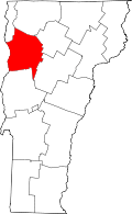 | |
| Towns | ||
| Villages | ||
| CDPs | ||
| Unincorporated communities | ||