Wiang Chai District
| Wiang Chai เวียงชัย | |
|---|---|
| Amphoe | |
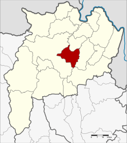 Amphoe location in Chiang Rai Province | |
| Coordinates: 19°52′59″N 99°55′59″E / 19.88306°N 99.93306°ECoordinates: 19°52′59″N 99°55′59″E / 19.88306°N 99.93306°E | |
| Country | Thailand |
| Province | Chiang Rai |
| Seat | Wiang Chai |
| Tambon | 5 |
| Muban | 75 |
| Amphoe established | June 17, 1974 |
| Area | |
| • Total | 258.8 km2 (99.9 sq mi) |
| Population (2008) | |
| • Total | 43,968 |
| • Density | 169.9/km2 (440/sq mi) |
| Time zone | UTC+7 (ICT) |
| Postal code | 57210 |
| Geocode | 5702 |
Wiang Chai (Thai: เวียงชัย; IPA: [wīaŋ tɕʰāj]) is a district (amphoe) in the central part of Chiang Rai Province, northern Thailand.
Geography
Neighboring districts are (from the west clockwise) Mueang Chiang Rai, Wiang Chiang Rung, Phaya Mengrai, and Thoeng of Chiang Rai Province.
The important water resource is the Kok River.
History
The minor district (king amphoe) was created on 17 June 1974, when the three tambon Wiang Chai, Thung Ko, and Pha Ngam were split off from Mueang Chiang Rai District. [1] It was upgraded to a full district on 25 March 1979.[2]
Administration
The district is divided into five sub-districts (tambon), which are further subdivided into 75 villages (muban). The township (thesaban tambon) Wiang Chai covers parts of tambon Wiang Chai and Mueang Chum. There are a further five tambon administrative organizations (TAO).
| No. | Name | Thai | Villages | Pop.[3] |
|---|---|---|---|---|
| 2. | Wiang Chai | เวียงชัย | 20 | 11,117 |
| 3. | Pha Ngam | ผางาม | 15 | 9,083 |
| 4. | Wiang Nuea | เวียงเหนือ | 12 | 6,574 |
| 6. | Don Sila | ดอนศิลา | 17 | 9,920 |
| 8. | Mueang Chum | เมืองชุม | 11 | 7,274 |
Missing numbers are tambon which now form Wiang Chiang Rung District.
References
- ↑ ประกาศกระทรวงมหาดไทย เรื่อง แบ่งท้องที่อำเภอเชียงราย จังหวัดเชียงราย ตั้งเป็นกิ่งอำเภอเวียงชัย (PDF). Royal Gazette (in Thai). 91 (100 ง): 2589. June 11, 1974.
- ↑ พระราชกฤษฎีกาตั้งอำเภอหนองกุงศรี อำเภอไทรงาม อำเภอบ้านฝาง อำเภออุบลรัตน์ อำเภอเวียงชัย อำเภอดอยเต่า อำเภอนิคมคำสร้อย อำเภอนาหว้า อำเภอเสิงสาง อำเภอศรีสาคร อำเภอบึงสามพัน อำเภอนาดูน อำเภอค้อวัง อำเภอโพธิ์ชัย อำเภอเมืองสรวง อำเภอปลวกแดง อำเภอยางชุมน้อย อำเภอกาบเชิง อำเภอสุวรรณคูหา และอำเภอกุดข้าวปุ้น พ.ศ. ๒๕๒๒ (PDF). Royal Gazette (in Thai). 96 (42 ก Special): 19–24. March 25, 1979.
- ↑ "Population statistics 2008". Department of Provincial Administration.
External links

- amphoe.com
Chiang Rai | ||
|---|---|---|
| Main article |  | |
| Capital city | ||
| Districts (amphoe) | ||
| Related topics | ||