Whitesville, Georgia
Whitesville is an unincorporated community in Harris County, Georgia, United States. A searchable map of this community can be viewed here
Geography
Geographical location:
- Latitude: 32° 8176' North
- Longitude: 85° 0313' West[1]
Elevation: 722 feet
Nearby cities and towns
- River View, Alabama (6.8 miles WSW)
- McGinty, Alabama (7.6 miles WSW)
- Jones Crossroads, Georgia (3.6 miles N)
- Hopewell, Georgia (4.5 miles E)
- Smiths Crossroads, Georgia (5.8 miles ENE)
- Mountain Hill, Georgia (6.6 miles S)
- Cottons Crossroads, Georgia (6.6 miles NW)
- Baughs Crossroads, Georgia (6.8 miles N)
- Smiths Mill, Georgia (7.4 miles NNE)[2]
Places
- Whitesville Methodist Episcopal Church, South, and Cemetery was registered on National Register of Historic Places.[3]
- Whitesville First Baptist Church[4]
References
- ↑ Current Local Time in Whitesville, Georgia
- ↑ Whitesville Populated Place Profile / Harris County, Georgia Data
- ↑ "National Register". nrhp.focus.nps.gov. Retrieved 2014-07-28.
- ↑ Whitesville Area News - Coal Valley News - coalvalleynews.com
External links
- Whitesville historical marker
- Whitesville Methodist Church Cemetery historical marker
- Whitesville Methodist Episcopal Church historical marker
Municipalities and communities of Harris County, Georgia, United States | ||
|---|---|---|
| Cities | 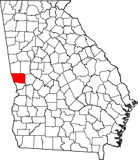 | |
| Towns | ||
| Unincorporated communities | ||
| Footnotes | ‡ This symbol represents that the indicated city is part of two or more counties. | |
Coordinates: 32°49′03″N 85°01′53″W / 32.81750°N 85.03139°W
This article is issued from
Wikipedia.
The text is licensed under Creative Commons - Attribution - Sharealike.
Additional terms may apply for the media files.