Ellerslie, Georgia
| Ellerslie, Georgia | |
|---|---|
| Unincorporated community | |
 Ellerslie  Ellerslie | |
| Coordinates: 32°37′53″N 84°48′4″W / 32.63139°N 84.80111°WCoordinates: 32°37′53″N 84°48′4″W / 32.63139°N 84.80111°W | |
| Country | United States |
| State | Georgia |
| County | Harris |
| Elevation | 722 ft (220 m) |
| Time zone | UTC-5 (Eastern (EST)) |
| • Summer (DST) | UTC-4 (EDT) |
| ZIP code | 31807 |
| Area code(s) | 706 |
| GNIS feature ID | 331650 |
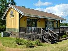
Ellerslie is an unincorporated community in Harris County, Georgia, United States. Ellerslie is a part of the Columbus, Georgia metropolitan area.[1]
History
A post office called Ellerslie has been in operation since 1828.[2][3]
Geography
Ellerslie is located along Alternate U.S. Route 27 and Georgia State Route 85, which run northeast to southwest through the city, leading southwest 18 miles (29 km) to Columbus and northeast 5 miles (8 km) to Waverly Hall. The two highways meet Georgia State Route 315 in the city to form a very short concurrency in the city limits. Atlanta is 93 miles (150 km) by road to the northeast. Ellerslie is approximately 722 feet (220 m) above sea level. It is located north of the fall line that separates Georgia into the Piedmont region and the Coastal Plains.
Education
The community is home to one of the seven schools in the county:
- Pine Ridge Elementary School
References
- ↑ http://georgia.hometownlocator.com/ga/harris/ellerslie.cfm
- ↑ "Post Offices". Jim Forte Postal History. Retrieved 13 May 2018.
- ↑ Krakow, Kenneth K. (1975). Georgia Place-Names: Their History and Origins (PDF). Macon, GA: Winship Press. p. 72. ISBN 0-915430-00-2.
External links
- The Wire Road historical marker
Municipalities and communities of Harris County, Georgia, United States | ||
|---|---|---|
| Cities | 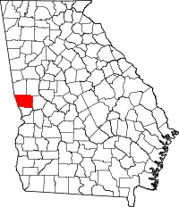 | |
| Towns | ||
| Unincorporated communities | ||
| Footnotes | ‡ This symbol represents that the indicated city is part of two or more counties. | |